Pyre Peak

Pyre Peak

Vorlage:Infobox Insel/Wartung/Bild fehltVorlage:Infobox Insel/Wartung/Höhe fehlt

Seguam Island
Gewässer Pazifischer Ozean
Inselgruppe Aleuten
Geographische Lage 52° 20′ N, 172° 25′ W52.333333-172.4166677Koordinaten: 52° 20′ N, 172° 25′ W
Seguam Island (Alaska)
DEC
Seguam Island
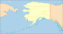
Länge 21 km
Breite 13 km
Fläche 207,3 km²
Einwohner (unbewohnt)

Seguam Island ist die östlichste Insel der Andreanof Islands, einer Inselgruppe im Südwesten der Aleuten.

Seguam Island

Die zum US-Bundesstaat Alaska zählende, unbewohnte Insel hat eine Landfläche von 207,3 km², ist 21 km lang und etwa 13 km breit. Im Westen befindet sich mit dem Vulkan Pyre Peak (auch Seguam-Vulkan genannt) (1.054 m) der höchste Punkt der Insel. Im Osten der Insel liegen noch zwei kleinere Vulkankegel.

Weblinks


Wikimedia Foundation.

Игры ⚽ Нужно решить контрольную?

Schlagen Sie auch in anderen Wörterbüchern nach:

  • Eternal Pyre — EP by Slayer Released June 6, 2006 Recorded NRG Studios in North Hollywood, and We …   Wikipedia

  • Table of the most isolated major summits of the United States — Main article: Mountain peaks of the United States See also: Table of the highest major summits of the United States and Table of the most prominent summits of the United States Contents 1 Table 2 …   Wikipedia

  • List of mountains of the United States — This list of mountains of the United States includes significant mountain peaks and high points located in the United States of America arranged alphabetically by state, district, or territory.ignificant mountain peaks and high points Alabama… …   Wikipedia

  • Table of the major 100 km summits of North America — Main article: Mountain peaks of North America The following sortable table lists the 234 mountain peaks of greater North America with at least 100 kilometers (62.14 miles) of topographic isolation and at least 500 meters… …   Wikipedia

  • Mountain peaks of Alaska — Mount McKinley (Denali) is the highest mountain peak of the State of Alaska, the United States of America, and all of North America. Main article: Geography of Alaska See also: Mountain peaks of the United States This article comprises three sor …   Wikipedia

  • Erdspalte — Spalte Spalteneruption nahe Pyre Peak auf der Aleuten Insel Seguam Eine Spalte (englisch: fissure) i …   Deutsch Wikipedia

  • Felsspalte — Spalte Spalteneruption nahe Pyre Peak auf der Aleuten Insel Seguam Eine Spalte (englisch: fissure) i …   Deutsch Wikipedia

  • Mount Seguam — Incandescent lava fountaining from a fissure eruption near Pyre Peak on Seguam Island. Elevation 3,45 …   Wikipedia

  • Seguam Island — Infobox Mountain Name= Seguam Island Photo= Caption= Elevation= Convert|3458|ft|m|0|abbr=on location=Aleutian Islands, Alaska, USA Range = Prominence = Coordinates = coord|52|19|22.2|N|172|28|37.6|W|type:mountain region:US|display=inline,title… …   Wikipedia

  • Seguam Island — Vorlage:Infobox Insel/Wartung/Höhe fehlt Seguam Island NASA Bild von Seguam Island Gewässer Pazifischer Ozean …   Deutsch Wikipedia

Share the article and excerpts

Direct link
Do a right-click on the link above
and select “Copy Link”