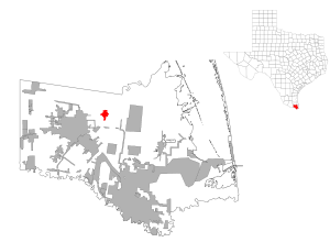
Rio Hondo, Texas — Infobox Settlement official name = Rio Hondo, Texas settlement type = City nickname = motto = imagesize = image caption = image mapsize = 250x200px map caption = Location of Rio Hondo, Texas mapsize1 = 250px map caption1 = subdivision type =… … Wikipedia
Rio Hondo — may refer to:*Río Hondo, a municipality in the Guatemalan department of Zacapa *Rio Hondo (Belize), a river which forms much of the border between Belize and Mexico *Rio Hondo (California), a tributary of the Los Angeles River in the U.S. state… … Wikipedia
Rio Hondo — oder Río Hondo ist der Name zahlreicher Flüsse: der Rio Hondo (New Mexico) ist ein 145 km langer Nebenfluss des Pecos Rivers der Río Hondo (Belize) ist ein 150 km langer Grenzfluss zwischen Mexiko und Belize der Rio Hondo (Kalifornien) ist ein 30 … Deutsch Wikipedia
Rio Hondo Independent School District — is a public school district based in Rio Hondo, Texas (USA).In addition to Rio Hondo, the district serves the communities of Arroyo Colorado Estates, Lozano, and Villa del Sol.chools*Rio Hondo High (Grades 9 12) *Rio Hondo Junior High (Grades 6… … Wikipedia
Rio Hondo — Rio Hondo, TX U.S. city in Texas Population (2000): 1942 Housing Units (2000): 787 Land area (2000): 1.392794 sq. miles (3.607320 sq. km) Water area (2000): 0.087495 sq. miles (0.226610 sq. km) Total area (2000): 1.480289 sq. miles (3.833930 sq.… … StarDict's U.S. Gazetteer Places
Rio Hondo, TX — U.S. city in Texas Population (2000): 1942 Housing Units (2000): 787 Land area (2000): 1.392794 sq. miles (3.607320 sq. km) Water area (2000): 0.087495 sq. miles (0.226610 sq. km) Total area (2000): 1.480289 sq. miles (3.833930 sq. km) FIPS code … StarDict's U.S. Gazetteer Places
Hondo (Texas) — Pour les articles homonymes, voir Hondo (homonymie). Hondo Administration Pays … Wikipédia en Français
Rio Grande Valley — This article is about the Lower Rio Grande Valley. For the New Mexico wine region along the Middle Rio Grande Valley, see Middle Rio Grande Valley AVA. The Rio Grande Valley (RGV) or the Lower Rio Grande Valley, informally called The Valley, is… … Wikipedia
Texas Air Museum — The Texas Air Museum currently has two locations, and one planned future location: * Stinson Municipal Airport (San Antonio, Texas) * Slaton, Texas * Snyder, Texas future location * Rio Hondo, Texas closed on February 28, 2005 with exhibits being … Wikipedia
Texas locations by per capita income — Texas is the thirty second richest state in the United States of America, with a per capita income of $19,617 (2000).Texas counties ranked by per capita incomeThere are 254 counties located in Texas, three of which are in the 100 richest counties … Wikipedia
 Lage in Texas