- Sherrelwood
-
Sherrelwood 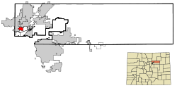 Lage in Colorado
Basisdaten Staat: Vereinigte Staaten Bundesstaat: Colorado County: Koordinaten: 39° 50′ N, 105° 0′ W39.840833333333-105.001666666671613Koordinaten: 39° 50′ N, 105° 0′ W Zeitzone: Mountain Standard Time (UTC−7) Einwohner: 17.657 (Stand: 2000) Bevölkerungsdichte: 2.802,7 Einwohner je km² Fläche: 6,4 km² (ca. 2 mi²)
davon 6,3 km² (ca. 2 mi²) LandHöhe: 1613 m Postleitzahl: 80221 FIPS: 08-69810 GNIS-ID: 1867088 Sherrelwood ist eine Stadt im Adams County im US-Bundesstaat Colorado, Vereinigte Staaten, mit 18.300 Einwohnern (Stand: 2004). Die geographischen Koordinaten sind: 39,84° Nord, 105,00° West. Das Einzugsgebiet der Stadt beträgt 6,4 km².
Kategorien:- Ort in Colorado
- Adams County (Colorado)

Wikimedia Foundation.