Te Araroa

Te Araroa

p1

Te Araroa
Te Araroa (Neuseeland)
Te Araroa
Koordinaten 37° 38′ S, 178° 22′ O-37.633333333333178.36666666667Koordinaten: 37° 38′ S, 178° 22′ O
Region Gisborne
Distrikt Gisborne

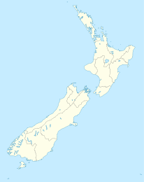
Te Araroa ist eine Gemeinde in der Region Gisborne im extremen Nordosten der Nordinsel Neuseelands. Sie liegt etwa 175 km nördlich der Stadt Gisborne am State Highway 35 zwischen Tokata und Awatere. In Te Araroa wurde der Māoripolitiker Sir Apirana Ngata geboren. Die Māori des Gebietes gehören traditionell zum Iwi Ngāti Porou.

In Te Araroa beginnt die Straße zum etwa 17 km weiter östlich befindlichen East Cape, dem östlichsten Punkt der Nordinsel.

Quellen


Wikimedia Foundation.

Игры ⚽ Поможем сделать НИР

Schlagen Sie auch in anderen Wörterbüchern nach:

  • Te Araroa Trail — Te Araroa (The Long Pathway) is New Zealand s newest long distance tramping route, from Cape Reinga to Bluff. It is being built by the Te Araroa Trust and is due for completion in 2010 some sections are already open. The straight line distance… …   Wikipedia

  • Te Araroa — Location map New Zealand label=Te Araroa lat dir=S | lat deg=37 | lat min=38 lon dir=E | lon deg=178 | lon min=22 position=left width=150 float=right caption=Te Araroa is a township in the Gisborne region of the North Island of New Zealand. It is …   Wikipedia

  • Те-Арароа — Город Те Арароа англ. Te Araroa Страна Новая ЗеландияНовая Зеландия …   Википедия

  • Apirana Ngata — The Honourable Sir Apirana Turupa Ngata MP Apirana Ngata, circa 1905 22nd Minister of Māori Affairs …   Wikipedia

  • New Zealand tramping tracks — Main article: Tramping in New Zealand A Department of Conservation track marker an orange triangular plastic pointer attached to trees and poles. In New Zealand, long distance walking or hiking for at least one overnight stay is known as tramping …   Wikipedia

  • Geoff Chapple (writer) — Geoff Chapple is a New Zealand author and journalist. His article in a Sunday newspaper began the volunteer movement to put in place a New Zealand long walking track. He mapped the track, then walked it and wrote the book Te Araroa The New… …   Wikipedia

  • New Zealand State Highway 2 — State Highway 2 Route information Maintained by …   Wikipedia

  • East Cape Lighthouse — Blick vom East Cape aufs offene Meer East Cape ist der östlichste Punkt der Hauptinseln Neuseelands und bezeichnet ein Kap im Nordosten der Nordinsel nördlich von Gisborne …   Deutsch Wikipedia

  • Metrosideros excelsa — Eisenholzbaum Metrosideros excelsa Systematik Klasse: Dreifurchenpollen Zweikeimblättrige (Rosopsida) …   Deutsch Wikipedia

  • Pohutukawa — Eisenholzbaum Metrosideros excelsa Systematik Klasse: Dreifurchenpollen Zweikeimblättrige (Rosopsida) …   Deutsch Wikipedia

Share the article and excerpts

Direct link
Do a right-click on the link above
and select “Copy Link”