- Tooraweenah
-
Tooraweenah 
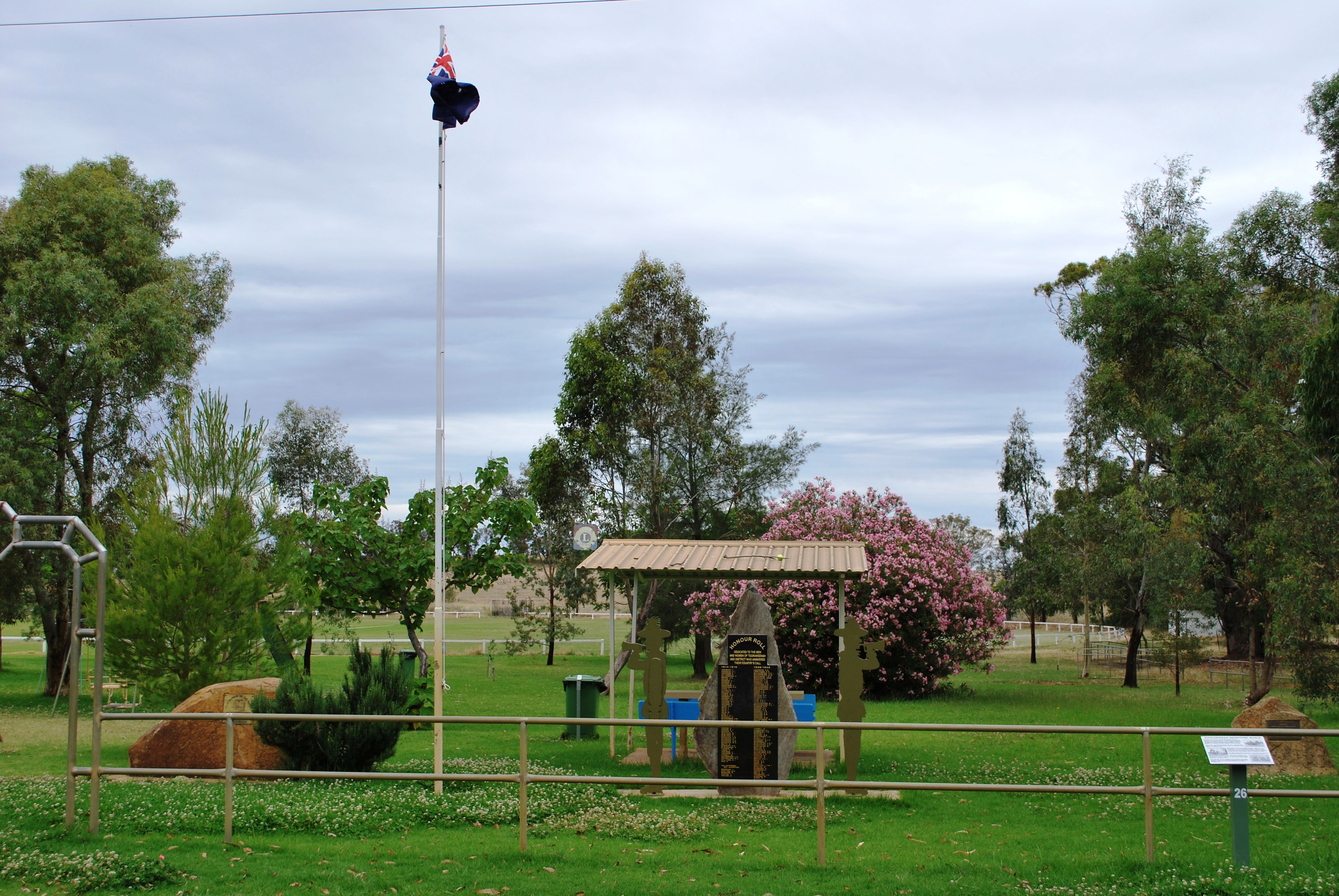
Kriegsdenkmal im Gedenken an den Kookaburra MarchStaat:  Australien
Bundesstaat:  New South Wales
Koordinaten: 31° 26′ S, 148° 55′ O-31.438888888889148.91111111111Koordinaten: 31° 26′ S, 148° 55′ O Einwohner: 239 (2006 [1]) Zeitzone: AEST (UTC+10) Postleitzahl: 2831 LGA: Gilgandra Shire Counci 

Tooraweenah Tooraweenah ist ein Dorf im australischen Bundesstaat New South Wales. Es liegt in einem Tal auf der westlichen Seite der Warrumbungles-Bergkette, zwischen den Städten Gilgandra im Südwesten und Coonabarabran im Nordosten, und gehört zum Verwaltungsgebiet Gilgandra Shire.[2] Derzeit leben etwa 240 Einwohner in Tooraweenah und der näheren Umgebung.
Geschichte
1837 wurde ein 16.000 Acre großes Gebiet durch den Squatter Andrew Brown in Besitz genommen. 1841 öffnete ein erster Laden und ein kleines Dorf begann heranzuwachsen. Durch den Land Settlement Act von 1861 wurde die Besiedelung der Gegend weiter gefördert. Im Jahre 1884 wurde eine Schule eröffnet, gefolgt von einem Hotel im Jahr 1886.[2]
1916 machten sich 23 Männer von Tooraweenah aus auf einen Marsch in die Stadt Bathurst auf, die älteste inländische Siedlung Australiens, um Männer für den Kriegsdienst im Ersten Weltkrieg zu rekrutieren. Heute erinnert ein Denkmal an diesen als Kookaburra March bekannt gewordenen Marsch.[2]
Im Jahr 1931 landete Cecil Arthur Butler nach seinem Direktflug von London nach Australien mit seinem Flugzeug nahe Tooraweenah. 1938 kehrte Butler zurück und gründete einen Luftpost- und Passagier-Service, der Charleville mit Sydney verband, mit Stationen in Cunnamulla, Bourke, Coonamble und Tooraweenah.[2]
Weblinks
-
 Commons: Tooraweenah – Sammlung von Bildern, Videos und Audiodateien
 - Tooraweenah Community-Website (englisch)
- The Sydney Morning Herald: Tooraweenah (englisch)
Einzelnachweise
- ↑ Australian Bureau of Statistics (25. Oktober 2007): Tooraweenah (State Suburb) (Englisch). 2006 Census QuickStats. Abgerufen am 28. Mai 2009.
- ↑ a b c d Tooraweenah. In: The Sydney Morning Herald. 8. Februar 2004, abgerufen am 22. März 2011 (englisch).
Kategorie:- Ort in New South Wales
-

Wikimedia Foundation.