Upper Beeding

Upper Beeding
Upper Beeding
Upper Beeding (Vereinigtes Königreich)
Upper Beeding
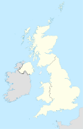
Upper Beeding
Lage von Upper Beeding
Beeding Bridge.JPG
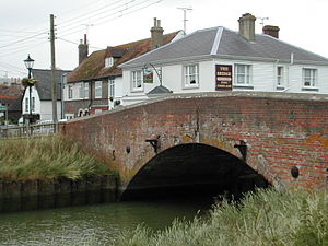
Basisdaten
Status Village
Region South East England
Zerem. Grafschaft West Sussex
District Horsham
Fläche 18.775 km²
Bevölkerung 3.798
ONS-Code 45UF
Website http://www.steyningsouthdowns.com

Upper Beeding ist eine Gemeinde im Distrikt Horsham in West Sussex, England. Es liegt nahe dem Fluss Adur im Norden der South Downs. Upper Beeding pflegt eine enge Zusammenarbeit mit den benachbarten Kommunen Bramber und Steyning.

Geschichte

Upper Beedings Geschichte reicht zurück bis in angelsächsische Zeiten. Damals verbanden sich die nah benachbarten Gemeinden Beeding und Sele zur Gemeinde Beeding. Für die längste Zeit seiner Geschichte hieß der heute als Upper Beeding bekannte Ort schlicht Beeding. Im 13. Jahrhundert gründeten Mönche jedoch im rund 15 Kilometer entfernten St. Leonhard's Forrest eine kleine Mission, die als Lower Beeding bekannt wurde. Vermutlich zur Unterscheidung der beiden Orte, erhielt Beeding das Präfix Upper. Ein genaues Datum dieser Namensänderung ist unbekannt. Fest steht jedoch, dass die Kirchengemeinde, die vermutlich der Auslöser war, die Namensänderung nicht mit vollzog und weiterhin als Kirche zu Beeding bekannt ist. Zahlreiche Einwohner verwehren sich auch heute noch gegen die Namensänderung und behalten den traditionellen Namen bei.

Infrastruktur

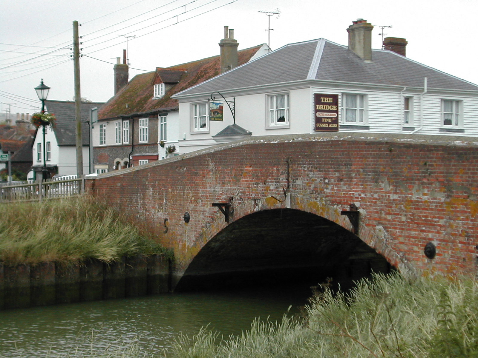
Upper Beeding liegt im Nationalpark South Downs und hat Anbindungen an die Radwanderwege South Downs Way und Monarch's Way. Die gesamte Umgebung ist bei Radwanderern, Wanderern und Reitern beliebt. Der kleine Ort selbst bietet einzelne Einkehrmöglichkeiten.


Wikimedia Foundation.

Игры ⚽ Поможем сделать НИР

Schlagen Sie auch in anderen Wörterbüchern nach:

  • Upper Beeding — infobox UK place country = England static static image caption= Beeding Bridge latitude= 50.88228 longitude= 0.30515 official name = Upper Beeding population = civil parish= Upper Beeding shire district= Horsham shire county= West Sussex region=… …   Wikipedia

  • List of schools in the South East of England — The following is a partial list of currently operating schools in the South East region of England. You may also find of use to find a particular school. See also the List of the oldest schools in the United Kingdom.Listed by local education… …   Wikipedia

  • Small Dole — infobox UK place country = England static static image caption= latitude= 50.90365 longitude= 0.27403 official name = Small Dole population = civil parish= Upper Beeding shire district= Horsham shire county= West Sussex region= South East England …   Wikipedia

  • Steyning Line — The Steyning Line (also known as the Adur Valley Line) was a railway line that connected the West Sussex market town of Horsham with the once bustling south coast port of Shoreham by Sea, with the possibility of an onward connection to Brighton.… …   Wikipedia

  • River Adur — The Adur is a river in Sussex, England. The Adur district of West Sussex is named after it. The river used to be navigable for large vessels up to the town of Steyning, where a large port used to be situated. However over time the river silted up …   Wikipedia

  • Adur (fleuve) — Adur (Beeding River, Bramber Water, Sore (tous noms désuets)) L’Adur, au nord ouest de Shoreham by Sea, en regardant vers l’amont. La cheminée en arrière plan est celle de la cimenterie abandonnée …   Wikipédia en Français

  • Crabtree, West Sussex — Coordinates: 51°00′52″N 0°15′42″W / 51.01443°N 0.26177°W / 51.01443; 0.26177 …   Wikipedia

  • Monarch's Way — Waymark on a Public Footpath Length 615 miles (990 km) Location Warwickshire, Worcestershire, Staffordshire, Sussex, Gloucesters …   Wikipedia

  • West Sussex Football League — The West Sussex Football League is a football competition in England. It has a total of 12 divisions of which the highest, the Premier Division, sits at level 12 of the English football league system. It is a feeder to the Sussex County League… …   Wikipedia

  • Edburton — infobox UK place country = England static static image caption= Edburton Church latitude= 50.88903 longitude= 0.24796 official name = Edburton population = civil parish= Upper Beeding shire district= Horsham shire county= West Sussex region=… …   Wikipedia

Share the article and excerpts

Direct link
Do a right-click on the link above
and select “Copy Link”