- Wainwright (Berg)
-
Als Wainwright werden Berge (Fells) im nordenglischen Nationalpark Lake District bezeichnet, die in dem siebenbändigen Werk Pictorial Guide to the Lakeland Fells des Autors und Illustrators Alfred Wainwright erwähnt werden. Insgesamt sind 214 Berge beschrieben. Es gibt keine Beschränkung nach Höhe, Lage oder topografischer Besonderheiten, sondern es ist eine Einteilung aus der persönlichen Sichtweise des Autors.
Um sie zu klassifizieren, wurden sie ähnlich anderen Zusammenstellungen von Bergen im Laufe der Zeit durch die Fellwalker (Bergwanderer) in Großbritannien allgemein als The Wainwrights bezeichnet.
Eine weitere Liste von 102 Hügeln geht aus dem später veröffentlichten Buch The Outlying Fells of Lakeland hervor. Diese außerhalb liegenden Fells werden jedoch allgemein nicht zu den Wainwrights gezählt.
In Großbritannien zählt das „Sammeln“ der Wainwrights und anderer klassifizierter Berge als skurrile Freizeitbeschäftigung (sog. „Peak Bagging“).
Inhaltsverzeichnis
Band 1: The Eastern Fells
 Helvellyn
- Helvellyn
- Nethermost Pike
- Catstye Cam
- Raise
- Fairfield
- White Side
- Dollywaggon Pike
- Great Dodd
- Stybarrow Dodd
- St Sunday Crag
- Hart Crag
- Dove Crag
- Watson's Dodd
- Red Screes
- Great Rigg
- Hart Side
- Seat Sandal
- Clough Head
- Birkhouse Moor
- Sheffield Pike
- High Pike
- Middle Dodd
- Little Hart Crag
- Birks
- Heron Pike
- Hartsop above How
- Great Mell Fell
- High Hartsop Dodd
- Little Mell Fell
- Low Pike
- Stone Arthur
- Gowbarrow Fell
- Nab Scar
- Glenridding Dodd
- Arnison Crag
Band 2: The Far Eastern Fells
- High Street
- High Raise
- Rampsgill Head
- Thornthwaite Crag
- Kidsty Pike
- Harter Fell
- Caudale Moor
- Mardale Ill Bell
- Ill Bell
- The Knott
- Kentmere Pike
- Froswick
- Branstree
- Yoke
- Gray Crag
- Rest Dodd
- Wether Hill
- Loadpot Hill
- Tarn Crag
- Place Fell
- Selside Pike
- Grey Crag
- Hartsop Dodd
- Shipman Knotts
- The Nab
- Angletarn Pikes
- Brock Crags
- Arthur's Pike
- Bonscale Pike
- Sallows
- Beda Fell
- Wansfell
- Sour Howes
- Steel Knotts
- Hallin Fell
- Troutbeck Tongue
Band 3: The Central Fells
- High Raise
- Sergeant Man
- Harrison Stickle
- Ullscarf
- Thunacar Knott
- Pike of Stickle
- Pavey Ark
- Loft Crag
- High Seat
- Bleaberry Fell
- Sergeant's Crag
- Steel Fell
- Tarn Crag
- Blea Rigg
- Calf Crag
- High Tove
- Eagle Crag
- Armboth Fell
- Raven Crag
- Great Crag
- Gibson Knott
- Grange Fell
- Helm Crag
- Silver How
- Walla Crag
- High Rigg
- Loughrigg Fell
Band 4: The Southern Fells
 Scafellkette
- Scafell Pike
- Sca Fell
- Great End
- Bowfell
- Esk Pike
- Crinkle Crags
- Lingmell
- Coniston Old Man
- Swirl How
- Brim Fell
- Great Carrs
- Allen Crags
- Glaramara
- Dow Crag
- Grey Friar
- Wetherlam
- Slight Side
- Pike o' Blisco
- Cold Pike
- Harter Fell
- Rossett Pike
- Illgill Head
- Seathwaite Fell
- Rosthwaite Fell
- Hard Knott
- Whin Rigg
- Green Crag
- Lingmoor Fell
- Black Fell
- Holme Fell
Band 5: The Northern Fells
- Skiddaw
- Blencathra
- Skiddaw Little Man
- Carl Side
- Long Side
- Lonscale Fell
- Knott
- Bowscale Fell
- Great Calva
- Bannerdale Crags
- Ullock Pike
- Bakestall
- Carrock Fell
- High Pike
- Great Sca Fell
- Mungrisdale Common
- Brae Fell
- Meal Fell
- Great Cockup
- Souther Fell
- Dodd
- Longlands Fell
- Binsey
- Latrigg
Band 6: The North Western Fells
 Grasmoor
- Grasmoor
- Eel Crag (Crag Hill)
- Grisedale Pike
- Wandope
- Sail
- Hopegill Head
- Dale Head
- Robinson
- Hindscarth
- Whiteside
- Scar Crags
- Whiteless Pike
- High Spy
- Causey Pike
- Maiden Moor
- Outerside
- Ard Crags
- Lord's Seat
- Knott Rigg
- Whinlatter
- Broom Fell
- Barf
- Barrow
- Catbells
- Graystones
- Ling Fell
- Sale Fell
- Rannerdale Knotts
- Castle Crag
Band 7: The Western Fells
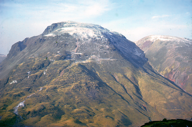
 Great Gable
- Great Gable
- Pillar
- Scoat Fell
- Red Pike (Wasdale)
- Steeple
- High Stile
- Kirk Fell
- Haycock
- Green Gable
- Red Pike (Buttermere)
- High Crag
- Brandreth
- Caw Fell
- Grey Knotts
- Seatallan
- Fleetwith Pike
- Base Brown
- Starling Dodd
- Yewbarrow
- Great Borne
- Middle Fell
- Haystacks
- Blake Fell
- Lank Rigg
- Gavel Fell
- Crag Fell
- Mellbreak
- Hen Comb
- Grike
- Burnbank Fell
- Buckbarrow
- Fellbarrow
- Low Fell
The Outlying Fells of Lakeland
- Walna Scar
- Black Combe
- Great Yarlside
- Howes
- Whitfell
- Great Saddle Crag
- Wasdale Pike
- Buck Barrow
- Burn Moor
- Kinmont Buck Barrow
- High Wether Howe
- White Howe
- Caw
- Lord's Seat
- Little Yarlside
- Seat Robert
- Capplebarrow
- Fewling Stones
- Sleddale Pike
- Hare Shaw
- Ulthwaite Rigg
- Stainton Pike
- High House Bank
- Yoadcastle
- Long Crag
- Robin Hood
- Nabs Moor
- Woodend Height
- Whatshaw Common
- Hesk Fell
- Stoupdale Head
- Pikes
- White Pike
- Great Ladstones
- Brunt Knott
- Great Worm Crag
- Hollow Moor
- Green Pikes
- Harper Hills
- Hugh's Laithes Pike
- White Combe
- Todd Fell
- Langhowe Pike
- Whiteside Pike
- Heughscar Hill
- Stickle Pike
- The Pike
- Lamb Pasture
- Dent
- Faulds Brow
- Knipescar Common
- Scalebarrow Knott
- Boat How
- Top O'Selside
- Ulgraves
- The Knott
- Gummer's How
- Rough Crag
- Carron Crag
- Ponsonby Fell
- Seat How
- Tarn Hill
- Great Stickle
- Water Crag
- Burney
- Cold Fell
- Caermote Hill
- The Knott
- Dunnerdale Fells
- High Knott
- Claife Heights
- Flat Fell
- Staveley Fell
- High Light Haw
- Hugill Fell
- Beacon Fell
- Reston Scarr
- Watch Hill
- Grandsire
- Blawith Knott
- Clints Crag
- Low Light Haw
- Latterbarrow
- Dunmallet
- Orrest Head
- Newton Fell North
- Scout Scar
- School Knott
- Muncaster Fell - Hooker Crag
- Tottle Bank Height
- Irton Pike
- Hampsfell
- Whitbarrow - Lord's Seat
- Wool Knott
- Cunswick Scar
- Yew Bank
- Brant Fell
- Bigland Barrow
- Finsthwaite Heights
- Raven Barrow
- Humphrey Head
Siehe auch
- Munro, Sir Hugh Munro, Corbett, Donald, Graham, Marilyn
Weblinks
- http://www.societies.ncl.ac.uk/fellwalkers/trips/bagging.shtml - Hewitt und andere Einteilungen
- http://www.stridingedge.net/Wainwright%20Fells/wainwrights.htm - Liste aller Wainwrights bei "Striding Edge" (englisch)
Kategorien:- Geographie (England)
- Berg nach Eigenschaft
- Lake District


Wikimedia Foundation.