- Whiteford Sands
-
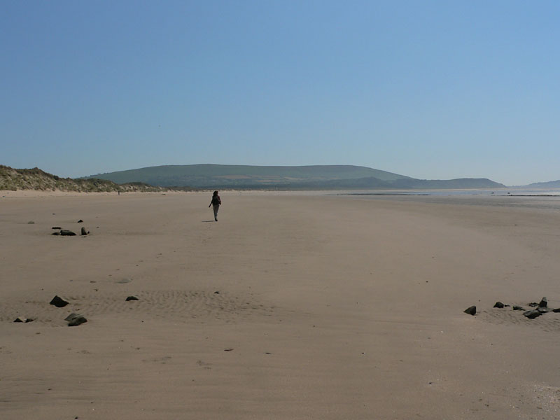
 Whiteford Sands, Gower, im Hintergrund Rhossili Down
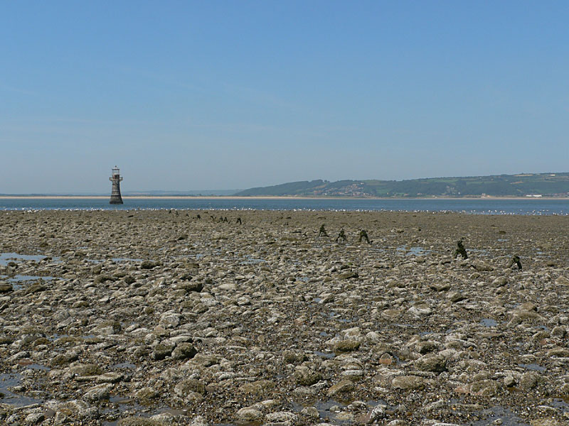
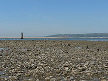 Whiteford Point, rechts die Reste des Steges zum Turm
 Whiteford Lighthouse, Gower
Whiteford Sands bezeichnet den Strand am nordwestlichen Ende der Gower-Halbinsel in Südwales, nördlich der Broughton Bay. Das nördliche Ende von Whiteford Sands liegt am Marschgebiet des River Loughor. Erreichbar ist der Strand nur über einen kaum sichtbaren Pfad, der am südlichen Ortsrand von Cwn Ivy nahe Cwm Ivy Tor beginnt.
Als Badestrand hat dieser Bereich keine Bedeutung, da er nur mit einigen Kilometern Fußweg erreichbar und zusätzlich als Vogelschutzgebiet ausgewiesen ist. An Whiteford Sands liegen die einzigen größeren Dünen auf Gower, am östlichen Rand stehen kleinere Pinienwälder, die auf Gower sonst kaum zu finden sind.
Inhaltsverzeichnis
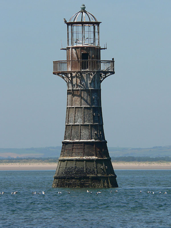
Whiteford Lighthouse
Am nördlichen Rand von Whiteford Sands, dem Whiteford Point, sind die markanten Überreste des Leuchtturms Whiteford Lighthouse weithin zu sehen; von ihm ist nur noch das Stahlgerüst erhalten. Er ist der einzige viktorianische Leuchtturm aus Gusseisen in Südwales und auch der einzige, der über einen stählernen Steg mit Holzbohlen bei Ebbe und Flut zugänglich war. Seine genaue Entstehungszeit ist unbekannt, es wird jedoch angenommen[1], dass er zwischen 1854 und 1865 erbaut wurde. Der Leuchtturm ging 1933 außer Betrieb. Er war ein sehr wichtiger Orientierungspunkt, da die Untiefen des River Loughor allein im Jahr 1868 sechzehn[1] Schiffe auf Grund gehen ließen, wobei insgesamt 30 Menschen ums Leben kamen. Die Schließung des Frachthafens in Llanelli am östlichen Ende der Bucht des River Loughor machte den Leuchtturm dann überflüssig und er wurde aufgegeben.
Die Überreste des Turms sind bei Niedrigwasser, ähnlich wie Worm’s Head und Burry Holmes, zu Fuß erreichbar.
Literatur
- Ordnance Survey (Hrsg.): Explorer Map 164 Gower, 2005, ISBN 0-319-23628-5
- Rough Guides Ltd. (Hrsg.): The Rough Guide to Wales, 07/2005, ISBN 1843536072 (engl.)
Weblinks
Einzelnachweise
51.636111111111-4.2536111111111Koordinaten: 51° 38′ 10″ N, 4° 15′ 13″ WKategorien:- Geographie (Wales)
- Swansea
- Strand im Vereinigten Königreich
Wikimedia Foundation.