Bow Island (Alberta)

Bow Island (Alberta)
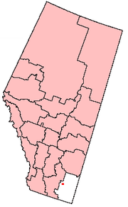
Lage von Bow Island in Alberta

Bow Island ist eine Kleinstadt im südlichen Alberta, Kanada mit 1790 Einwohnern.

Inhaltsverzeichnis

Geschichte

Um 1900 erreichten die ersten Familien Bow Island. 1910 folgte der offizielle Dorfstatus, im März 1912 wurde Bow Island als Stadt klassifiziert. Über die Herkunft des Namens Bow Island existieren viele Geschichten. Die wohl bekannteste ist, dass die 25 km weiter westlich gelegende Gemeinde Grassy Lake ehemals Bow Island hieß und ihre Namen einfach vertauscht wurden.

In den frühen 1950ern wurde die Wasserversorgung auf das Umland ausgeweitet, was eine Verdopplung der Einwohnerzahl zur Folge hatte. Bow Island liegt inmitten von etwa 450 km² fruchtbarer Landfläche. Einige der neuesten und modernsten Bewässerungssysteme der Welt befinden sich dort.

Kultur

Blues at the Bow Live ist ein 1994 eröffnetes Blueskonzertprogramm. Die immer ausverkauften Konzerte findet im historischen Bow Theatre statt und locken Gäste aus der gesamten Provinz an.[1]

Demografie

Die auf 790 m Höhe gelegene Stadt hatte 2006 eine Bevölkerung von 1790, die sich auf 631 Haushalte verteilte. Bei einer Fläche von 5,92 km² ergibt sich eine Bevölkerungsdichte von 302,4 Einwohnern pro Quadratkilometer.[2]

Quellen/Weblinks

  1. Blues at the Bow: Offizielle Seite
  2. Statistics Canada: Bow Island (Abgerufen 2007-12-20)

49.866667-111.3666677Koordinaten: 49° 52′ N, 111° 22′ W


Wikimedia Foundation.

Игры ⚽ Нужен реферат?

Schlagen Sie auch in anderen Wörterbüchern nach:

  • Bow Island, Alberta — Infobox Settlement official name = Town of Bow Island other name = native name = nickname = settlement type = Town motto = imagesize = image caption = flag size = image seal size = image shield = shield size = city logo = citylogo size = mapsize …   Wikipedia

  • Bow Island — Lage in Alberta …   Deutsch Wikipedia

  • Bow Island Airport — is located convert|1|NM|abbr=on|lk=in northeast of Bow Island, Alberta, Canada.ReferencesExternal links* [http://www.copanational.org/PlacesToFly/airport view.php?pr id=2 ap id=874 Page about this aerodrome] on COPA s Places to Fly airport… …   Wikipedia

  • Alberta Health Services — Type Health Care Industry Health care Founded May 2008 …   Wikipedia

  • Alberta Highway 15 — Highway 15 Route information Maintained by Alberta Transportation, the City of Edmonton, and the City of Fort Saskatchewan Length …   Wikipedia

  • Alberta general election, 2008 — 2004 ← members March 3, 2008 (2008 03 03) …   Wikipedia

  • Alberta provincial electoral districts — are currently single member ridings that each elect one member to the Legislative Assembly of Alberta. There are 83 current districts fixed in law in Alberta.HistoryThe original twenty five districts were drawn up by Liberal Member of Parliament… …   Wikipedia

  • Alberta — Albertan, adj., n. /al berr teuh/, n. 1. a province in W Canada. 1,799,771; 255,285 sq. mi. (661,190 sq. km). Cap.: Edmonton. Abbr.: Alba., Alta. 2. a female given name, form of Albertine. * * * Province (pop., 2001: 2,974,807), Canada,… …   Universalium

  • Alberta federal electoral districts — As of 2006, the province of Alberta has 28 electoral districts represented in the Canadian House of Commons.List of electoral districts*Calgary Centre *Calgary Centre North *Calgary East *Calgary Northeast *Calgary Southeast *Calgary Southwest… …   Wikipedia

  • List of communities in Alberta — Distribution of town and cities in Alberta. Rural and spe …   Wikipedia

Share the article and excerpts

Direct link
Do a right-click on the link above
and select “Copy Link”