Burlington County (New Jersey)

Burlington County (New Jersey)
Verwaltung
US-Bundesstaat: New Jersey
Verwaltungssitz: Mount Holly Township
Adresse des
Verwaltungssitzes:
County Office Building
49 Rancocas Road, PO Box 6000
Mount Holly, NJ 08060-1388
Gründung: 17. Mai 1694
Gebildet aus: West Jersey
Vorwahl: +1 609 oder +1 856
Demographie
Einwohner: 423.394  (2000)
Bevölkerungsdichte: 203,2 Einwohner/km²
Geographie
Fläche gesamt: 2.122 km²
Wasserfläche: 38 km²
Karte
Karte von Burlington County innerhalb von New Jersey
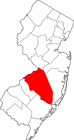
Website: www.co.burlington.nj.us

Burlington County ist ein County im US-Bundesstaat New Jersey. Im Jahr 2000 hatte das County 423.394 Einwohner und eine Bevölkerungsdichte von 203 Einwohner / km². Der Sitz der Countyverwaltung (County Seat) ist in Mount Holly Township.

Geschichte

Das County hat eine Fläche von 2.122 km², wovon 38 km² Wasseroberfläche sind.

Demografische Daten

Das durchschnittliche Einkommen eines Haushalts liegt bei 58.608 USD, das durchschnittliche Einkommen einer Familie bei 67.481 USD.
Männer haben ein durchschnittliches Einkommen von 46.381 USD gegenüber den Frauen mit durchschnittlich 32.228 USD. Das Pro-Kopf-Einkommen liegt bei 26.339 USD.
4,70 % der Einwohner und 3,20 % der Familien leben unterhalb der Armutsgrenze.
25,20 % der Einwohner sind unter 18 Jahre alt und auf 100 Frauen ab 18 Jahre und darüber kommen statistisch 95,60 Männer.
Das Durchschnittsalter beträgt 37 Jahre. (Stand: 2000).

Städte und Ortschaften

  • Bass River Township
  • Beverly
  • Bordentown Township
  • Bordentown
  • Browns Mills
  • Burlington Township
  • Burlington
  • Chesterfield Township
  • Cinnaminson Township
  • Country Lake Estates
  • Delanco Township
  • Delran Township
  • Eastampton Township
  • Edgewater Park Township
  • Evesham Township
  • Fieldsboro
  • Florence Township
  • Florence-Roebling
  • Fort Dix
  • Hainesport Township
  • Leisuretowne
  • Lumberton Township
  • Mansfield Township
  • Maple Shade Township
  • Marlton
  • McGuire AFB
  • Medford Lakes
  • Medford Township
  • Moorestown Township
  • Moorestown-Lenola
  • Mount Holly Township
  • Mount Laurel Township
  • New Hanover Township
  • North Hanover Township
  • Palmyra
  • Pemberton Heights
  • Pemberton Township
  • Pemberton
  • Presidential Lakes Estates
  • Ramblewood
  • Riverside Township
  • Riverton
  • Shamong Township
  • Southampton Township
  • Springfield Township
  • Tabernacle Township
  • Washington Township
  • Westampton Township
  • Willingboro Township
  • Woodland Township
  • Wrightstown


39.88-74.677Koordinaten: 39° 53′ N, 74° 40′ W


Wikimedia Foundation.

Игры ⚽ Поможем написать курсовую

Schlagen Sie auch in anderen Wörterbüchern nach:

  • Burlington County, New Jersey — Infobox U.S. County county = Burlington County state = New Jersey seallink = show map size = 100 founded = May 17, 1694 seat = Mount Holly largest city = Moorestown area total sq mi =819 area land sq mi =805 area water sq mi =15 area percentage …   Wikipedia

  • Mansfield Township, Burlington County, New Jersey — Mansfield Township, New Jersey   Township   Mansfield Township highlighted in Burlington County. I …   Wikipedia

  • Springfield Township, Burlington County, New Jersey — see also: Springfield Township, Union County, New Jersey for another township in New Jersey with the same name Infobox Settlement official name = Springfield Township, New Jersey settlement type = Township nickname = motto = imagesize = image… …   Wikipedia

  • National Register of Historic Places listings in Burlington County, New Jersey — List of the National Register of Historic Places listings in Burlington County, New Jersey Contents: Counties in New Jersey   Atlantic Bergen Burlington Camden Cape May Cumberland Essex Gloucester Hudson Hunterdon Mercer Middlesex Monmouth… …   Wikipedia

  • Washington Township, Burlington County, New Jersey — Infobox Settlement official name = Washington Township, New Jersey settlement type = Township nickname = motto = imagesize = image caption = image mapsize = 250x200px map caption = Washington Township highlighted in Burlington County. Inset… …   Wikipedia

  • Mount Pleasant (Burlington County, New Jersey) — Mount Pleasant hill, ca. 2010 Mount Pleasant is a historic community located within the southeastern range of Mansfield Township and the northeastern range of Springfield Township, Burlington County, New Jersey. Mount Pleasant encompasses the… …   Wikipedia

  • Washington Township School District (Burlington County, New Jersey) — The Washington Township School District is a community public school district that serves students in Kindergarten through eighth grade from Washington Township, in Burlington County, New Jersey, United States. The district participates in the… …   Wikipedia

  • Seal of Burlington County, New Jersey — The Seal of Burlington County, New Jersey consists of a wagon proceeding over a cement causeway with seagulls in attendance. The wording around the seal is Board of Chosen Freeholders of Burlington County, New Jersey , the name of the county… …   Wikipedia

  • List of Registered Historic Places in Burlington County, New Jersey — NOTOC This is intended to be a complete list of properties and districts listed on the National Register of Historic Places in Burlington County, New Jersey. The locations of National Register properties and districts (at least for all showing… …   Wikipedia

  • Burlington Township, New Jersey — See also: Burlington, New JerseyInfobox Settlement official name = Burlington Township, New Jersey settlement type = Township nickname = motto = imagesize = image caption = image mapsize = 250x200px map caption = Burlington Township highlighted… …   Wikipedia

Share the article and excerpts

Direct link
Do a right-click on the link above
and select “Copy Link”