- Bästeträsk
-
Bästeträsk Geographische Lage: Gotland, Schweden Daten Koordinaten 57° 54′ 0″ N, 18° 56′ 0″ O57.918.933333333333Koordinaten: 57° 54′ 0″ N, 18° 56′ 0″ O 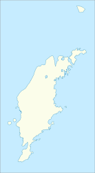

Fläche 6,3 km² Maximale Tiefe ca. 6 m Mittlere Tiefe ca. 4,5 m Der See Bästeträsk (auch: Bäste träsk) liegt auf der Insel Gotland, welche zu Schweden gehört. Er liegt im Norden der Insel, ca. 12 km westlich von Fårösund. Mit einer Fläche von 6,3 km² ist er der größte See der Insel. Der See ist für seine große Anzahl an Regenbogenforellen und Meerforellen bekannt. Im Winter kann man auf dem See eislaufen. Der See ist mit einem 250 Meter langem Abfluss mit der Ostsee verbunden.

Wikimedia Foundation.