- Belubula River
-
Belubula River 
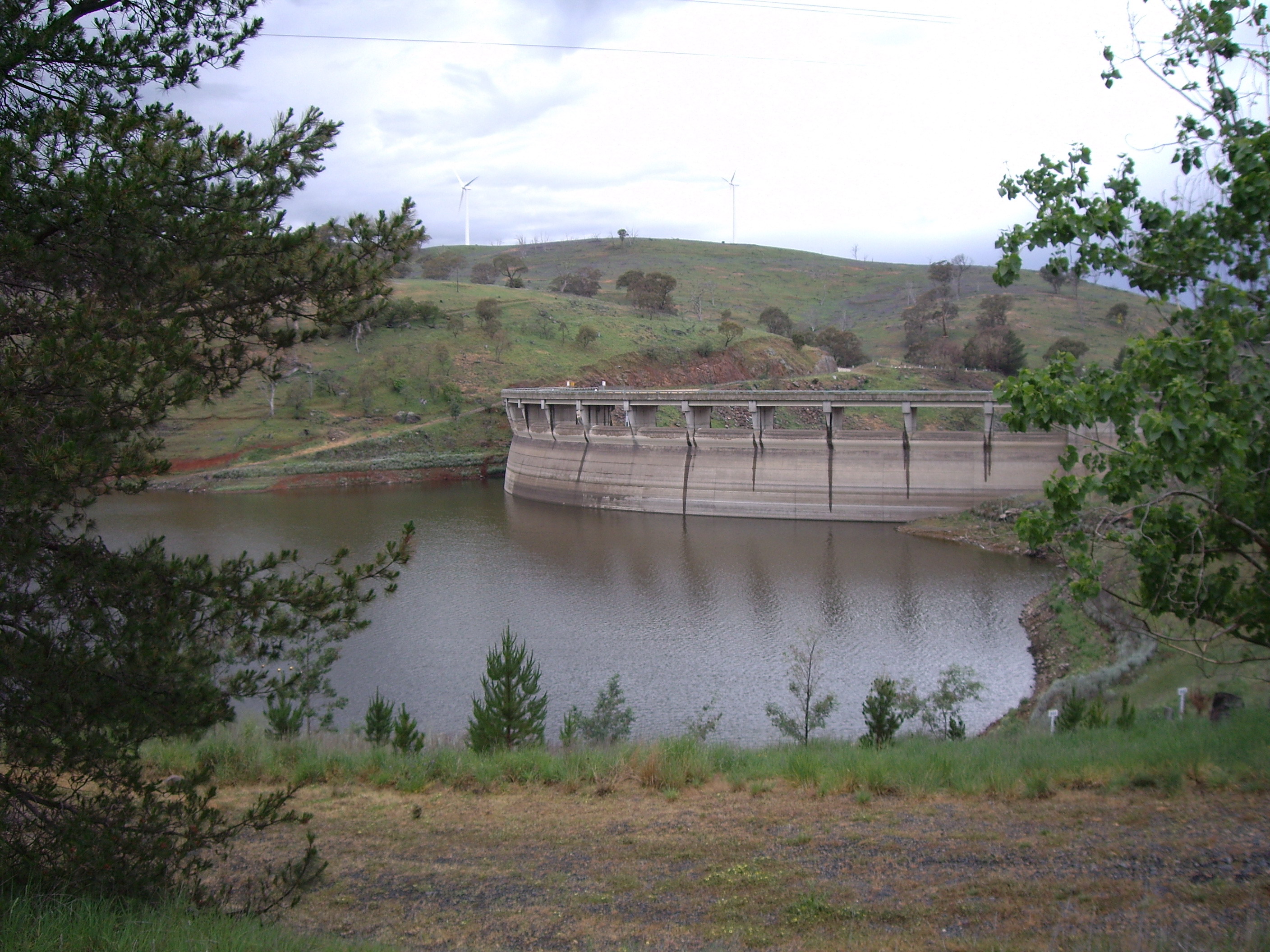
Der Carcoar-Staudamm am Belubula River
Daten Lage New South Wales (Australien) Flusssystem Murray River Abfluss über Lachlan River → Murrumbidgee River → Murray River → Indischer Ozean Quelle südlich von Vittoria (westlich von Bathurst) Quellhöhe 936 m[1] Mündung Lachlan River bei Gooloogong -33.55148.46666666667262Koordinaten: 33° 33′ 0″ S, 148° 28′ 0″ O
33° 33′ 0″ S, 148° 28′ 0″ O-33.55148.46666666667262Mündungshöhe 262 m[1] Höhenunterschied 674 m Länge 165 km[1] Rechte Nebenflüsse Cadiangullong Creek, Swallow Creek, Panuara Rivulet, Nyrang Creek Linke Nebenflüsse Coombing Creek, Mandurama Ponds, Limestone Creek, Jacks Creek Durchflossene Stauseen Carcoar-Stausee Mittelstädte Blayney, Canowindra Kleinstädte Carcoar Der Belubula River ist ein Fluss im Zentrum des australischen Bundesstaates New South Wales.
Er entspringt südlich von Vittoria, einer Kleinstadt westlich von Bathurst, und fließt nach Westen durch die Städte Blayney und Canowindra. Bei Gooloogong mündet er in den Lachlan River.
Östlich der Kleinstadt Carcoar ist der Fluss zum Carcoar-Stausee angestaut.
Quelle
Weblinks
 Commons: Belubula River – Sammlung von Bildern, Videos und Audiodateien
Einzelnachweise
Kategorien:- Flusssystem Murrumbidgee River
- Fluss in New South Wales
- Fluss in Australien und Ozeanien
Wikimedia Foundation.