Caribou-Targhee National Forest
- Caribou-Targhee National Forest
-
Der Caribou-Targhee National Forest besteht aus den beiden Gebieten Caribou National Forest, mit neun Teilgebieten und dem Targhee National Forest mit zwei Teilgebieten. Er ist Teil des Größeren Yellowstone-Ökosystems. Angrenzend an das Schutzgebiet sind im Westen die zwei Nationalparks, Grand Teton und Yellowstone sowie die Schutzgebiete Bridger-Teton National Forest, Jedediah Smith Wilderness und Winegar Hole Wilderness. Im National Forest gibt es Dutzende von Campingplätzen und 2.500 km Wanderwege. Aufgrund des Vorkommens von Kalkstein gibt es hier viele Karsterscheinungen und Höhlen.
Flora und Fauna
In den westlichen Teilen kommen Wüsten-Beifuß und verschiedene Grasarten vor. In den höheren Lagen sind Küsten-Kiefern und diverse Fichten- und Tannenarten vorherrschend. Neben Grizzlys kommen Berglöwen, Bisons, Elche, Gabelböcke, Maultiere, Schwarzbären, Wapitis und Wölfe vor. Daneben wurde ein Programm zur Wiederansiedlung von Wanderfalken gestartet. An Fischen kommen Bachsaiblinge, Cutthroatforellen und Hechte vor.
Weblinks
Kategorien:
- Geographie (Idaho)
- National Forest (Vereinigte Staaten)
Wikimedia Foundation.
Schlagen Sie auch in anderen Wörterbüchern nach:
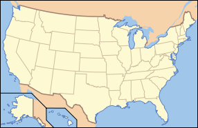
Caribou-Targhee National Forest — Infobox protected area | name = Caribou Targhee National Forest iucn category = VI caption = locator x = 65 locator y = 48 location = Idaho Wyoming Utah, USA nearest city = Pocatello, ID lat degrees = 42 lat minutes = 47 lat seconds = 0 lat… … Wikipedia
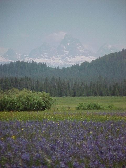
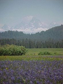
United States National Forest — Camas flowers and the west vista of the Teton Range in Caribou Targhee National Forest, Idaho National Forest is a classification of federal lands in the United States. National Forests are largely forest and woodland areas owned by the … Wikipedia
National Forest — Tongass Nationalforst in Alaska Ein Nationalforst (engl. National Forest) ist in den Vereinigten Staaten von Amerika ein Waldgebiet unter der Kontrolle der Bundesregierung, das vom US Forest Service verwaltet wird. Größter Nationalforst ist mit… … Deutsch Wikipedia
Bighorn National Forest — IUCN Category VI (Managed Resource Protected Area) … Wikipedia
Nez Perce National Forest — IUCN Category VI (Managed Resource Protected Area) … Wikipedia
Salmon-Challis National Forest — Sawmill Challis National Forest IUCN Category VI (Managed Resource Protected Area) … Wikipedia
Targhee Pass — Infobox Mountain Pass Name = Targhee Pass Photo = Caption = Elevation = 7072 ft./2156 m. Location = Idaho / Montana, USA Range = Rocky Mountains Coordinates = coord|44|40.47|N|111|16.51|W |type:pass region:US |display=inline,title Topographic… … Wikipedia
Foret nationale de Caribou-Targhee — Forêt nationale de Caribou Targhee Forêt nationale de Caribou Targhee Catégorie VI de la CMAP (Zone de gestion de ressources protégées) … Wikipédia en Français
Forêt Nationale De Caribou-Targhee — Catégorie VI de la CMAP (Zone de gestion de ressources protégées) … Wikipédia en Français
Forêt nationale de caribou-targhee — Catégorie VI de la CMAP (Zone de gestion de ressources protégées) … Wikipédia en Français

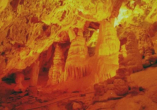
 Minnetonka Cave