Cape MacLear

Cape MacLear
Cape MacLear
Cape MacLear (Malawi)
Cape MacLear
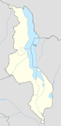
Cape MacLear
Basisdaten
Staat Malawi
Region Südregion
Distrikt Mangochi
ISO 3166-2 MW-MG
Cape MacLear am Malawisee
-14.02166666666734.845277777778

Cape MacLear ist ein Dorf in Malawi nordwestlich der Monkey Bay am Ufer des Malawisees. Es hat sich in den letzten Jahren zu einem Erholungsort vor allem für junge Rucksacktouristen entwickelt. Einige billige Guesthouses drängen sich am schmalen Strand und bieten neben einfachen Zimmern auch Zeltplätze an. Es existiert ein privat geführtes Krankenhaus, das die Einheimischen versorgt. Westlich des Dorfes liegt der Malawisee-Nationalpark, den man mit gemieteten Kanus oder zu Fuß erkunden kann. Zwei PADI-Tauchschulen befinden sich direkt am Strand. Viele junge Männer aus dem Dorf sind im Tourismus-Geschäft tätig, verkaufen selbstgebastelten Schmuck und Cannabis, veranstalten Grillabende am Strand oder rudern Touristen zu den vorgelagerten Inseln.


Wikimedia Foundation.

Игры ⚽ Нужен реферат?

Schlagen Sie auch in anderen Wörterbüchern nach:

  • Cape Maclear — Infobox Settlement official name = Cape Maclear other name = native name =Chembe nickname = The Capecite web|url=http://www.imt.ie/news/2008/06/life as a gp in malawi the war.html|title=Life as a GP in Malawi the warm heart of… …   Wikipedia

  • Maclear Island (Queensland) — Maclear Island is part of the Great Barrier Reef Marine Park at the tip of Cape Melville, Queensland in Bathurst Bay.It is North of Denham Island in the Flinders Group National Park. It is South of Flinders Island. Aerial photos maps …   Wikipedia

  • Maclear (crater) — lunar crater data latitude=10.5 N or S=N longitude=20.1 E or W=E diameter=20 km depth=0.6 km colong=340 eponym=Thomas MaclearMaclear is a lava flooded crater on the northwest part of the Mare Tranquillitatis, a lunar mare in the eastern half of… …   Wikipedia

  • Thomas Maclear — Sir Thomas Maclear (March 17, 1794 ndash;July 14, 1879) was an Irish born South African astronomer who became Astronomer Royal at the Cape of Good Hope.He was born in Newtownstewart, County Tyrone, Ireland, the eldest son of James Maclear. In… …   Wikipedia

  • Marine geology of the Cape Peninsula and False Bay — Contents 1 Introduction 2 The geological structure of the region 2.1 Malmesbury group deposition 2.1.1 Appearance of the exposed Malmesbury group rocks …   Wikipedia

  • Geological Commission of the Cape of Good Hope Publications — The Geological Commission of the Cape of Good Hope published a number fof series of publications during its existence from 1896 to 1911Reference: Price, R.R.M. Catalogue of Publications of South African Geological Surveys and Government… …   Wikipedia

  • Rhodes, Eastern Cape — Rhodes is a hamlet or small village alongside the trout rich Bell River, at the foot of Ben MacDhui (at 3001m the highest mountain in the Cape region) in the Drakensberg mountains of the north Eastern Cape, South Africa. History Rhodes is located …   Wikipedia

  • R396 (Eastern Cape) — The R396 is a Regional Route in South Africa that connects the N2 north of Mthatha to Indwe via Maclear, Rhodes, and Barkly East.External links* [http://www.routes.co.za/route/R300/R396/index.html Routes Travel Info] …   Wikipedia

  • Monkey Bay — Lusumbwe Beach at Cape Maclear near Monkey Bay …   Wikipedia

  • Malawi-See — Malawisee Malawisee aus dem Orbit Geographische Lage: Ostafrika Abflüsse …   Deutsch Wikipedia

Share the article and excerpts

Direct link
Do a right-click on the link above
and select “Copy Link”