- Douméga
-
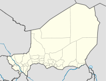
12.9722222222223.9788888888889Koordinaten: 12° 58′ N, 3° 59′ O

Douméga Douméga ist eine Landgemeinde im Departement Dogondoutchi der nigrischen Region Dosso. Sie hat 35.469 Einwohner (2010).[1]
Die Gemeinde grenzt direkt an den Nachbarstaat Nigeria. Nördlich von Douméga liegt die Gemeinde Tibiri, südlich und westlich die Gemeinde Guéchémé. Die drei Orte befinden sich alle am Wadi Dallol Maouri, der in den Fluss Niger mündet, und am Übergang der Sahelzone zur fruchtbaren Großlandschaft Sudan. Die für nigrische Verhältnisse dicht besiedelte Gemeinde Douméga besteht aus mehreren Dörfern, von denen die bevölkerungsreichsten Douméga, Birnin Falla (mit Fala Goubé), Zoumbou und Zazatou sind. Das Dorf Angoual Magagi befindet sich direkt beim Grenzübergang zu Nigeria. Insgesamt ist das Gemeindegebiet in 40 traditionelle Dörfer, 23 administrative Dörfer und zwei Weiler gegliedert.[2]
Das traditionelle Oberhaupt im Nachbarort Tibiri nimmt eine regionale Führungsposition ein, wobei ihm die Berechtigung dazu vom traditionellen Oberhaupt von Douméga abgesprochen wird. Ersterer besitzt seine legitime Abstammung nur matrilinear, während letzterer eine patrilineare Abstammungsfolge vorweisen kann. Die Familie des 1999 getöteten nigrischen Präsidenten Ibrahim Baré Maïnassara stammte ebenfalls aus Douméga.
In Douméga spielt die Landwirtschaft eine wichtige Rolle. Im Tal des Dallol Maouri werden neben Hirse, Sorghum und Erderbsen auch Gemüse, Obst, Maniok, Süßkartoffeln und Zuckerrohr angebaut. Douméga ist außerdem ein Handelsplatz für den grenzübergreifenden Handel mit Nigeria.
Literatur
- Ahmad Tijani Malam Maoussa: Nouvelle structure des échanges frontaliers Niger-Nigeria: le marché de Dadin Kowa. In: John Ogunsola Igué et Kossiwa Zinsou-Klassou: Frontières, espaces de développement partagé. Karthala, Paris 2010, ISBN 978-2-8111-0372-9, S. 135–146
Einzelnachweise
- ↑ Institut national de la statistique (Hrsg.): Annuaire statistique des cinquante ans d’indépendence du Niger. Niamey 2010 (Online-Version), S. 54.
- ↑ Répertoire National des Communes (RENACOM). Website des Institut National de la Statistique, abgerufen am 22. Januar 2011.
Kategorien:- Ort in Niger
- Dosso (Region)

Wikimedia Foundation.