Engure

Engure
Engure
Wappen fehlt
Hilfe zu Wappen
Engure (Lettland)
Red pog.svg
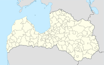
Basisdaten
Staat: Lettland
Landschaft: Kurland (lettisch: Kurzeme)
Verwaltungsbezirk: Engures novads
Koordinaten: 57° 10′ N, 23° 13′ O57.16055555555623.224444444444Koordinaten: 57° 9′ 38″ N, 23° 13′ 28″ O
Einwohner:
Fläche:
Bevölkerungsdichte:
Höhe:
Webseite: www.engure.lv

Engure ist ein Ort in Lettland am Golf von Riga, 71 km westlich der Hauptstadt.

Geschichte

Der Ort taucht erstmals 1245 in einer Urkunde auf, die eine Grenze zwischen dem Gebiet des Deutschen Ordens und des Bischofs von Kurland bestimmt. Später wurde ein Hafen eingerichtet. Heute ist der Ort ein beliebtes Ausflugsziel.

Engures Novads

2009 schlossen sich die Gemeinden Engure, Smārde sowie der bereits bestehende Lapmežciema novads zum Engures novads zusammen.(Siehe auch: Verwaltungsgliederung Lettlands). Das Verwaltungszentrum befindet sich in Smārde. Auf 397,9 km² leben 8045 gemeldete Einwohner. Teile des Nationalpark Ķemeri sind in diesem Gebiet. Der Engure-See ist einer der größten Seen Lettlands.

Literatur


Wikimedia Foundation.

Игры ⚽ Нужно сделать НИР?

Schlagen Sie auch in anderen Wörterbüchern nach:

  • Engure — Original name in latin Engure Name in other language Anger, Engurciems, Engure State code LV Continent/City Europe/Riga longitude 57.16061 latitude 23.22527 altitude 6 Population 1600 Date 2010 12 04 …   Cities with a population over 1000 database

  • Engure — Sp Eñgurė Ap Engure L Latvija …   Pasaulio vietovardžiai. Internetinė duomenų bazė

  • Engurė — Sp Eñgurė Ap Engure L Latvija …   Pasaulio vietovardžiai. Internetinė duomenų bazė

  • Engure-See — Bild gesucht  BW Geographische Lage Kurland,Lettland Orte am Ufer …   Deutsch Wikipedia

  • Lago Engure — País  Letonia Localización Distrito de Talsi …   Wikipedia Español

  • Lake Engure — Infobox lake lake name = Lake Engure image lake = caption lake = image bathymetry = |caption bathymetry = coords = coord|57|16|N|23|06|E|region:LV type:waterbody|display=inline,title location = Talsi district type = inflow = outflow = Mersraga… …   Wikipedia

  • Lake Engure Nature Park — is a protected park in Latvia covering 197.62 km². It was designed as a nature spot in 1998 …   Wikipedia

  • Municipalidad de Engure — Municipalidad de Engures Engures novads Municipalidad de Letonia …   Wikipedia Español

  • Mērsrags — The rural municipality of Mērsrags (Markgrafen) is located on the west coast of the Gulf of Riga (Latvia), beside Lake Engure and surrounded by extensive woodlands. It’s situated in northwest Latvia in wooded lowland close the sea. It is in the… …   Wikipedia

  • Apšuciems — Hilfe zu Wappen …   Deutsch Wikipedia

Share the article and excerpts

Direct link
Do a right-click on the link above
and select “Copy Link”