- Little Yarra River
-
Little Yarra River 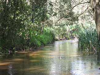
Little Yarra River in Yarra Junction
Daten Lage Victoria (Australien) Flusssystem Yarra River Abfluss über Yarra River → Port Phillip Bay → Bass-Straße Quelle bei The Bump (Yarra Ranges)
37° 50′ 16″ S, 145° 40′ 47″ O-37.837777777778145.67972222222254Koordinaten: 37° 50′ 16″ S, 145° 40′ 47″ OQuellhöhe 254 m[1] Mündung Yarra River Mündungshöhe 107 m[1] Höhenunterschied 147 m Länge 23,7 km[1] Rechte Nebenflüsse Britannia Creek Kleinstädte Powelltown, Gladysdale, Yarra Junction Der Little Yarra River ist ein Nebenfluss des Yarra River. Er entspringt in den Wäldern der Yarra Ranges bei The Bump[1] in der Nähe von Powelltown. Nur wenige Kilometer östlich liegt die Quelle des Latrobe River. Der Little Yarra River fließt dann durch Bauernland und mündet bei Yarra Junction in den Yarra River[2][3].
Einzelnachweise
- ↑ a b c d Map of Little Yarra River, VIC. Bonzle.com
- ↑ Port Phillip and Westernport Regional River Health Strategy. Melbourne Water & Port Phillip an Westernport Catchment Management Authority
- ↑ Melbourne’s Rivers and Creeks 2004. Melbourne Water & Port Phillip an Westernport Catchment Management Authority
Kategorien:- Flusssystem Yarra River
- Fluss in Victoria
- Fluss in Australien und Ozeanien

Wikimedia Foundation.