Matankari

Matankari
13.7616666666674.0075
Matankari (Niger)
Matankari
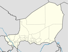
Matankari

Matankari ist eine Landgemeinde im Departement Dogondoutchi der nigrischen Region Dosso. Sie hat 77.200 Einwohner (2010).[1]

Matankari liegt rund 20 Kilometer nördlich der Departementshauptstadt Dogondoutchi und gehört zur Sahelzone. Westlich des Ortszentrums von Matakari verläuft das Wadi Dallol Maouri. Das Gemeindegebiet ist in 185 traditionelle Dörfer, 19 administrative Dörfer, neun Weiler, sieben Lager und eine Wasserstelle gegliedert.[2] Bis ins 20. Jahrhundert war Matankari der Sitz des Sarkin Arewa, des traditionellen Oberhaupts der Arewa, einer Untergruppe der Maouri, die wiederum eine Untergruppe der Hausa sind und durch besondere Skarifizierungen gekennzeichnet sind. 1903 gründeten die Franzosen einen Militärposten in Matankari. Als dieser Militärposten wenige Jahre später in die Stadt Dogondoutchi verlegt wurde, war auch der Sarkin Arewa gezwungen, seinen Amtssitz nach Dogondoutchi zu übersiedeln.[3]

Einzelnachweise

  1. Institut national de la statistique (Hrsg.): Annuaire statistique des cinquante ans d’indépendence du Niger. Niamey 2010 (Online-Version), S. 54.
  2. Répertoire National des Communes (RENACOM). Website des Institut National de la Statistique, abgerufen am 22. Januar 2011.
  3. Jolijn Geels: Niger. Bradt, Chalfont St Peter 2006, ISBN 1-84162-152-8, S. 139.

Wikimedia Foundation.

Игры ⚽ Поможем сделать НИР

Schlagen Sie auch in anderen Wörterbüchern nach:

  • Matankari — is a town in southwestern Niger. It is near the city of Niamey. Coordinates: 13°48′22″N 4°01′55″E / 13.806075°N 4.031982°E / 13.806075 …   Wikipedia

  • Dogondoutchi — 13.654.0333333333333 Koordinaten: 13° 39′ N, 4° 2′ O …   Deutsch Wikipedia

  • List of cities in Niger — Map of Niger Niamey, Capital of Niger …   Wikipedia

  • Diffa —   Urban Commune   …   Wikipedia

  • N'guigmi — Nguigmi, Ngigmi Camel riders line up outside the residence of the traditional chief of Nguigmi …   Wikipedia

  • Dosso, Niger — Dosso Officials at the opening of the Regional Maternity hospital, 2008 …   Wikipedia

  • Djado Plateau — The ruined city of Djado, with nomadic women gathered in the foreground. October 1989. The Djado Plateau lies in the Sahara, in north eastern Niger. It is known for its cave art (often of large mammals long since absent from the area), but is now …   Wikipedia

  • Dakoro — is a town and commune located in the Maradi Region of Niger. Coordinates: 14°30′N 6°45′E /  …   Wikipedia

  • Dogondoutchi — Dogondoutchi …   Wikipedia

  • Mayahi — (var. Mayaki) is a town located in the Maradi Region of Niger. It is the seat of Mayahi Department and a Commune about 45km from Tessaoua. In the mid 1990s it had a population of 2,200.[1] The name Mayaki is also a rulers title among the Sudié… …   Wikipedia

Share the article and excerpts

Direct link
Do a right-click on the link above
and select “Copy Link”