Naltar-Pass

Naltar-Pass

xBWxx

Naltar-Pass
Osten, Naltar-Tal Westen
Passhöhe 4.600 m
Region, Land Gilgit-Baltistan, Pakistan
Ausbau Bergweg
Karte (Pakistan)
Naltar-Pass (Pakistan)
Naltar-Pass
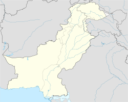
Koordinaten 36° 20′ 19″ N, 74° 2′ 37″ O36.33872222222274.0437444444444600Koordinaten: 36° 20′ 19″ N, 74° 2′ 37″ O

Der Naltar-Pass ist ein Hochgebirgspass mit einer Scheitelhöhe von 4600 Metern über N.N. in Gilgit-Baltistan im Norden von Pakistan im Gilgit-Distrikt. Der Pass liegt im Norden des Shani Peak im Naltar-Tal und kann nur begangen werden. Shani ist die Ausgangsbasis zum Naltar-Pass, das Tor zum Ishkoman-Tal.[1] Im Westen des Naltar-Passes liegt der Chaprot-Pass und im Osten der Hayal-Pass.

Im Naltar-Tal befindet sich der Naltar-See, aus dem der Naltar-Fluss entspringt. In diesem Hochtal, das Touristen und Einheimische auf Treckingtouren durchwandern, befinden sich wildlebende Bergziegen, Steinböcke, Schraubenziegen und weitere Tiere der Region.

Weblink

Einzelnachweis

  1. Reisebericht auf www.south-asia.com

Wikimedia Foundation.

Игры ⚽ Поможем написать курсовую

Schlagen Sie auch in anderen Wörterbüchern nach:

  • Naltar Pass — (36°20′06″N 74°2′39″E / 36.335°N 74.04417°E / 36.335; 74.04417Coordinates …   Wikipedia

  • Hayal Pass — Infobox Mountain Pass Name = Hayal Pass Photo = Caption = Elevation = 4600 m. Location = PAK Range = Coordinates = Topographic Transversed by =Hayal Pass (el. 4600 m.) is a high mountain pass to the north of Shani Peak in Naltar Valley. The pass… …   Wikipedia

  • Bichhar-Pass — xBWxxx Bichhar Pass Süden Norden Passhöhe …   Deutsch Wikipedia

  • Chaprot Pass — Elevation 16,090 ft (4,904 m) Location Location …   Wikipedia

  • Districts of Northern Areas — The Northern Areas is the northernmost of two political entities that have been under Pakistani control since 1947 but which, constitutionally, do not actually form part of Pakistan s national territory. (The other political entity is Azad Jammu… …   Wikipedia

  • Geography of Gilgit-Baltistan — Districts of Gilgit Baltistan Gilgit Baltistan has been under Pakistani control since 1947 and was given full autonomy on August 29, 2009 and is now constitutionally an integrated part of Pakistan.[1] Gilgit Baltistan comprises seven districts… …   Wikipedia

  • Gilgit District — Infobox Pakistan district district = Gilgit District area = population = pop year = density = caption = Map of the Northern Areas of Pakistan, showing the six districts and tehsil boundaries. region = Northern Areas established = nazim = naib… …   Wikipedia

  • Gilgit (Distrikt) — Karte der Nordgebiete Pakistans Der Gilgit Distrikt ist einer der sieben Distrikte (Skardu , Ghanche , Ghizar , Hunza Nagar , Diamir und Astore Distrikt) der autonomen Region von Gilgit Baltistan im Norden von Pakistan. Er wurde 1970 gegründet,… …   Deutsch Wikipedia

  • Shani Peak — Infobox Mountain Name = Shani Peak Photo = Caption = Elevation = 5,887 metres (19,309 feet) Location = Naltar Pass, Pakistan Range = Karakoram Prominence = Coordinates = coord|36|17|58.57|N|74|1|31.78|E|type:mountain… …   Wikipedia

  • List of mountain passes — This is a list of mountain passes. Africa *Halfaya Pass *Moteng Pass (Lesotho) *Mahlasela pass (Lesotho)Asia* Khunjerab Pass Pakistan China (highest international border crossing at 4693 m.) * Khyber Pass Pakistan Afghanistan * Kotal e Lataband * …   Wikipedia

Share the article and excerpts

Direct link
Do a right-click on the link above
and select “Copy Link”