Palčje

Palčje
Palčje
Wappen fehlt
Hilfe zu Wappen
Karte von Slowenien, Position von Palčje hervorgehoben
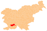
Basisdaten
Staat: Slowenien
Historische Region: Küstenland (Primorska)
Statistische Region: Notranjsko-kraška (Region Innerkrain-Karst)
Koordinaten: 45° 41′ N, 14° 15′ O45.67591666666714.257016666667602Koordinaten: 45° 40′ 33″ N, 14° 15′ 25″ O
Höhe: 602 m. i. J.
Fläche: 30,58 km²
Einwohner: 208 (2002)
Bevölkerungsdichte: 7 Einwohner je km²
Kfz-Kennzeichen: PO
Struktur und Verwaltung
Webpräsenz:
Palčje (9. März 2009)

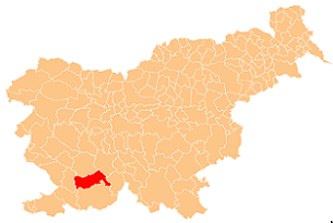
Palčje ist ein Dorf im Osten der Gemeinde Pivka des Küstenlandes Primorska im Karst-Gebiet der historischen Krain in Slowenien mit 208 Einwohnern (2002).[1]

Die dem hl. Nikolaus geweihte Ortskirche am Marktplatz im Zentrum, im 17. Jahrhundert erbaut, untersteht der Kirchengemeinde Trnje.[2]

Nördlich des Dorfs liegt der zeitweilig austrocknende Palčje-See. Er ist der größte der Seen in der Gemeinde Pivka mit einer durchschnittlichen maximalen Wasseroberfläche von einem Quadratkilometer.[3]

Weblinks

Einzelnachweise

  1. http://www.stat.si/krajevnaimena/default.asp?txtIme=PAL%C8JE&selNacin=celo&selTip=naselja&ID=3247
  2. http://kp.rkc.si/dokumenti/zupnije/seznam.pdf
  3. http://www.pivka.si/podrocje.aspx?id=80

Wikimedia Foundation.

Игры ⚽ Нужен реферат?

Schlagen Sie auch in anderen Wörterbüchern nach:

  • Palčje-See — Blick vom Ufer Richtung Nordost Geographische Lage Nördlich Palčje Daten …   Deutsch Wikipedia

  • Meža — The Meža is a 43 kilometres (27 mi) long river in Carinthia, Slovenia.[1] It has its source on the Austrian side of the state border near Mount Olševa, becomes subterranean a kilometer from its source, and reappears on the surface in… …   Wikipedia

  • Dravinja — The Dravinja River in Zreče Origin Pohorje Massif, southwest of Mount Rogla Length 73 km (45 mi) …   Wikipedia

  • Triglav Lakes Valley — Dvojno jezero the Double Lake, photographed from the Triglav Lakes Hut The Triglav Lakes Valley or the Lake Triglav Valley (Slovene: Dolina Triglavskih jezer) is a rocky hanging valley in the Julian Alps in Slovenia, below the sheer sides of… …   Wikipedia

  • Nevljica — is a river in the Kamnik municipality, Slovenia. It comes out under Kozjak and flows through the Tuhinj Valley. It also flows through the village of Nevlje. Many bones of an ice age mammoth were found by Nevljica river in this village in 1938.… …   Wikipedia

  • Lake Cerknica — Cerkniško jezero With the summit of Slivnica in the background (winter) Location Inner Carniola Coordinates …   Wikipedia

  • List of German exonyms for places in Slovenia — This is a list of German language exonyms for places located in Slovenia. Those names are mostly of a historic value.* Ajdovščina Haidenschaft * Apače Abstall * Artiče Artitsch bei Rann * Begunje pri Cerknici Vigaun bei Zirknitz * Begunje pri… …   Wikipedia

  • Radovna Valley — The Radovna Valley The Radovna Valley (Slovene: Dolina Radovne) is an alpine valley in the Julian Alps in the Upper Carniola region of Slovenia. Radovna Creek, created by smaller tributaries from the glacial valleys of the Krma and Kot valleys,… …   Wikipedia

  • Idrijca — The Idrijca River near the Wild Lake The upper Idrijca River …   Wikipedia

  • Wild Lake — Location near Idrija, Slovenia Basin countries Slovenia The Wild Lake or Savage Lake (Slovene …   Wikipedia

Share the article and excerpts

Direct link
Do a right-click on the link above
and select “Copy Link”