Phillip Island Nature Park
- Phillip Island Nature Park
-
Der Phillip Island Nature Park ist ein Naturpark auf Phillip Island im Staat Victoria (Australien).
Geschichte
Der Park wurde 1996 gegründet; er unterhält sich finanziell selbst durch verschiedene Touristenattraktionen. Als im Jahr 2000 ein Ölteppich den Lebensraum der Pinguine bedrohte, organisierten Tierfreund ein medienwirksames Pinguinpulloverstricken. [1]
Attraktionen
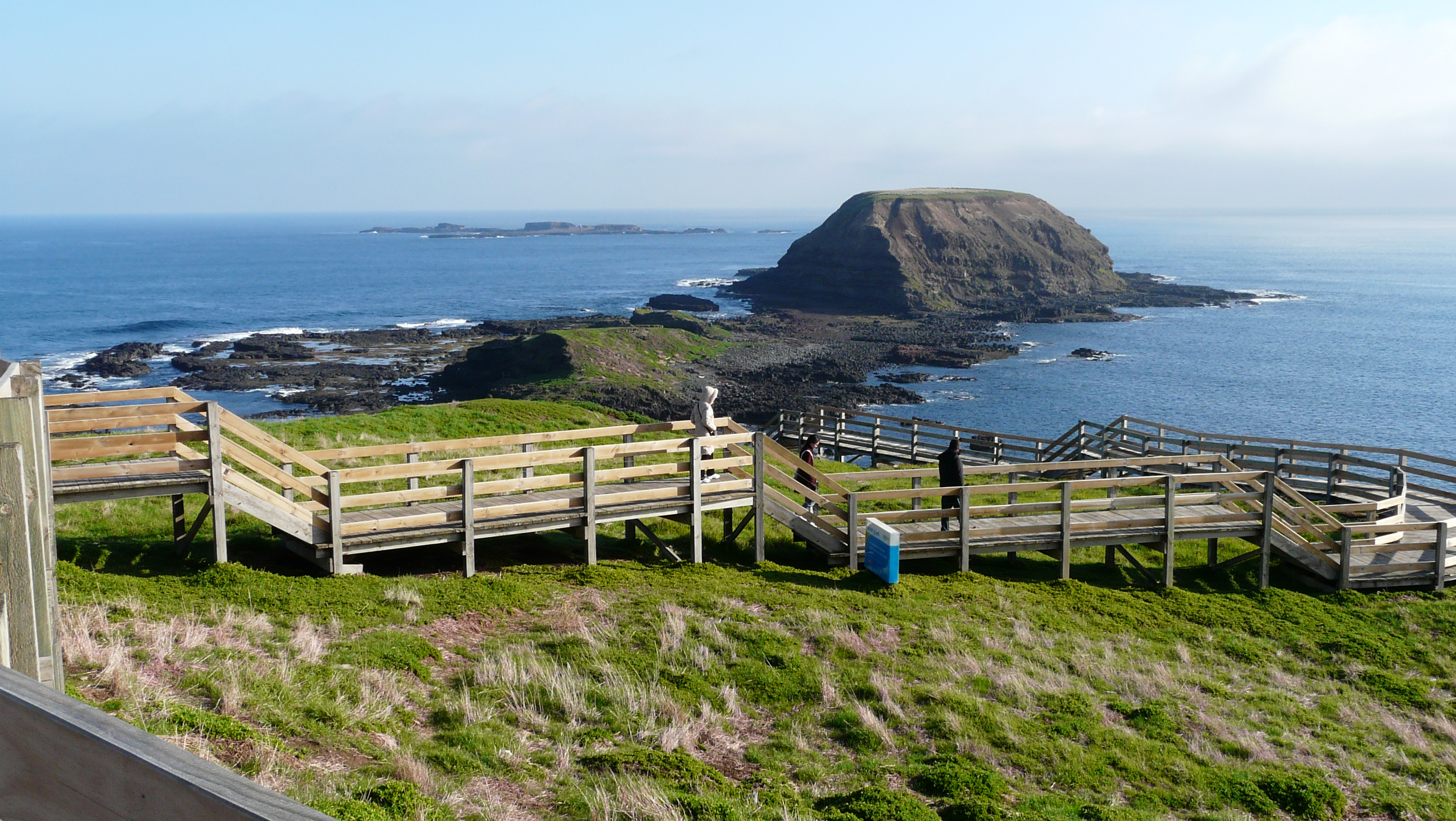
Zum Park gehören die Naturattraktionen Pyramid Rock, Rhyll Inlet, Seal Rocks und Cape Woolamai[2]. International bekannt ist die Zwergpinguin-Parade (die Tiere kommen in der Dämmerung an Land)[3][4]; weitere Angebote sind das Koala Conservation Center oder das Nobbies Center (Seehunde, Haie, Delphine).[5]
Weblinks
Einzelnachweise
- ↑ http://www.factmonster.com/spot/penguinsweater.html
- ↑ http://commons.wikimedia.org/wiki/Category:Cape_Woolamai,_Victoria
- ↑ "The little penguins of Phillip Island", in: BBC Wildlife Magazine 25 (9): 91-100.
- ↑ Collins, M. ; Cullen, J.M. ; Dann, P.: "Seasonal and annual foraging movements of little penguins from Phillip Island, Victoria", in: Wildlife research 26 (6): 705-722.
- ↑ http://www.penguins.org.au/images/stories/ate%20german%2009%20flier%20de.pdf
-38.483305145.233267
Kategorien:
- Nationalpark in Victoria
- Naturschutzgebiet in Australien und Ozeanien
Wikimedia Foundation.
Schlagen Sie auch in anderen Wörterbüchern nach:
Phillip Island Nature Park — (PINP) is a conservation park located on Phillip Island, Victoria, Australia. Created in 1996, the park is owned by the Victorian State Government, however it is a self funding commercial attraction for the purpose of animal conservation and… … Wikipedia
Phillip Island (Victoria) — Phillip Island is located about 140km away from Melbourne.Named after Governor Arthur Phillip, Phillip Island in Victoria, Australia, forms a natural breakwater for the shallow waters of Western Port Bay. The island area is approximately 10,000… … Wikipedia
Phillip Island — Küste von Phillip Island Gewässer Bass Straße Geographische Lage … Deutsch Wikipedia
Phillip Island — may refer to:* Phillip Island (Victoria) ** Phillip Island Grand Prix Circuit **Phillip Island Nature Park * Phillip Island (Norfolk Island) … Wikipedia
Cooper Mountain Nature Park — Prairie at the park with the Nature House in the background Type Public Location Near … Wikipedia
Hinchinbrook Island — Infobox protected area of Australia | name = Hinchinbrook Island National Park iucn category = II caption = locator x = 225 locator y = 53 nearest town or city = Cardwell coordinates = coord|18|13|46|S|146|13|58|E|type:landmark region:AU area =… … Wikipedia
Lion Island (New South Wales) — Infobox protected area | name = Lion Island iucn category = Ia caption = Lion Island viewed from West Head location = New South Wales nearest city = Gosford area = 8 ha established = 1956 governing body = NSW National Parks and Wildlife… … Wikipedia
Oxbow Regional Park — Sandy River in Oxbow Park during summer Type Regional park Location near Springdale, Multnomah County, Oregon … Wikipedia
Long Island (New South Wales) — Long Island is one of a number of small, forested islands of the Hawkesbury River. It is situated about 50km north of Sydney, across Sandbrook Inlet from Brooklyn, Others include Dangar Island, Spectacle Island, Milson Island, Peat Island and… … Wikipedia
List of recurring South Park characters — The following is a list of recurring characters in the animated television series South Park. This does not include the school children, family members or the school staff. Contents 1 Big Gay Al … Wikipedia
 Bei Nobbies Center
 Commons: Phillip Island – Sammlung von Bildern, Videos und Audiodateien