Ten Mile Pool

Ten Mile Pool
Ten Mile Pool

Photo-request.svg

Bild gesucht 

BW

Geographische Lage Western Australia (Australien)
Zuflüsse Murchison River
Abfluss Murchison River
Größere Städte in der Nähe Coolcalaya
Daten
Koordinaten 27° 48′ 59″ S, 114° 46′ 19″ O-27.81637336114.77191596184Koordinaten: 27° 48′ 59″ S, 114° 46′ 19″ O
Ten Mile Pool (Westaustralien)
Ten Mile Pool
Höhe über Meeresspiegel 184 m
Fläche 7 haf5
Länge 900 mf6
Breite 120 mf7

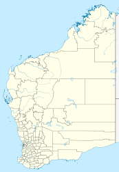
Der Ten Mile Pool ist ein See im Westen des australischen Bundesstaates Western Australia.

Der See liegt im Verlauf des Murchison River nordöstlich der Siedlung Coolcalaya.

Weblinks und Quellen


Wikimedia Foundation.

Игры ⚽ Поможем написать реферат

Schlagen Sie auch in anderen Wörterbüchern nach:

  • Ten Mile Island at Big Horn Rentals — (Фриско,США) Категория отеля: Адрес: 110 South First Avenue, Фриско, CO 8 …   Каталог отелей

  • Mile End — For other uses, see Mile End (disambiguation). Coordinates: 51°31′29″N 0°01′53″W / 51.5248°N 0.0314°W / 51.5248; 0.0314 …   Wikipedia

  • Murchison River (Western Australia) — Murchison River Lage des Flusses in Western Australia DatenVorlage:Infobox Fluss/GKZ fehlt …   Deutsch Wikipedia

  • Greater New York Councils — Owner …   Wikipedia

  • List of localities in Victoria (Australia) — Map of Local Government Areas in Victoria This is a list of locality names and populated place names in the state of Victoria, Australia, outside the Melbourne metropolitan area. It is organised by region from the south west of the state to the… …   Wikipedia

  • Marina Bay Sands — Address 10 Bayfront Avenue Singapore 018956 +65 6688 8888 Opening date …   Wikipedia

  • Thorold, Ontario — Infobox Settlement official name = City of Thorold nickname = motto = imagesize = image caption = image blank emblem = image shield = shield size = mapsize = map caption = Location of Thorold in the Niagara Region subdivision type = Country… …   Wikipedia

  • Hudson River — Coordinates: 40°42′11″N 74°01′36″W / 40.70306°N 74.02667°W / 40.70306; 74.02667 …   Wikipedia

  • North Attleborough, Massachusetts —   Town   North Attleborough Town Hall Nickname …   Wikipedia

  • Starved Rock State Park — Coordinates: 41°19′17″N 88°59′25″W / 41.32139°N 88.99028°W / 41.32139; 88.99028 …   Wikipedia

Share the article and excerpts

Direct link
Do a right-click on the link above
and select “Copy Link”