- Two Hummock Island
-
Two Hummock Island Gewässer Südlicher Ozean Inselgruppe Palmer-Archipel Geographische Lage 64° 8′ 0″ S, 61° 42′ 0″ W-64.133333333333-61.7670Koordinaten: 64° 8′ 0″ S, 61° 42′ 0″ W 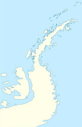

Länge 8 km Höchste Erhebung 670 m Einwohner (unbewohnt) Two Hummock Island (hummock: engl. für „Eishügel“) ist eine eisbedeckte Insel vor der Westküste der Antarktischen Halbinsel. Sie liegt im Palmer-Archipel etwa 8 km südöstlich von Liège Island. Die Insel erreicht in Nord-Süd-Richtung eine maximale Ausdehnung von 8 km.
Namensgebend für die Insel sind ihre zwei markanten Felsgipfel, die eine Höhe von 670 m erreichen. Über mehr als 100 Jahre trägt die Insel diesen Namen, der sich international durchgesetzt hat.
Inseln im Palmer-ArchipelAnvers-Insel | Brabant-Insel | Doumer-Insel | Goudier-Insel | Hoseason Island | Liège Island | Melchior-Inseln | Ohlin Island | Tower Island | Trinity Island | Two Hummock Island | Wiencke-Insel
Wikimedia Foundation.
Schlagen Sie auch in anderen Wörterbüchern nach:
Two Hummock Island — (coord|64|8|S|61|42|W|) is an ice covered island, 5 miles (8 km) long in a north south direction, conspicuous for its two rocky summits 670 m high, lying 5 miles (8 km) southeast of Liege Island in the Palmer Archipelago. This name has appeared… … Wikipedia
Three Hummock Island — is an island with an area of 70 km2 and a high point 237 m above sea level, in Bass Strait, south eastern Australia. It is part of Tasmania’s Hunter Island Group which lies between north west Tasmania and King Island. The island is named after… … Wikipedia
Cobalcescou Island — Geography Location Antarctica Coordinates 64°11′S 61°39′W … Wikipedia
Hoseason Island — Vorlage:Infobox Insel/Wartung/Bild fehltVorlage:Infobox Insel/Wartung/Fläche fehltVorlage:Infobox Insel/Wartung/Höhe fehlt Hoseason Island Gewässer Bransfieldstraße (Südlicher Ozean) Inselgruppe Palmer Archipel … Deutsch Wikipedia
Ohlin Island — Vorlage:Infobox Insel/Wartung/Bild fehltVorlage:Infobox Insel/Wartung/Fläche fehltVorlage:Infobox Insel/Wartung/Höhe fehlt Ohlin Island Gewässer Bransfieldstraße (Südlicher Ozean) Inselgruppe Palmer Archipel … Deutsch Wikipedia
Tower Island — Vorlage:Infobox Insel/Wartung/Bild fehltVorlage:Infobox Insel/Wartung/Fläche fehlt Tower Island Gewässer Bransfieldstraße (Südlicher Ozean) Inselgruppe Palmer Archipel Geograp … Deutsch Wikipedia
Trinity Island — Vorlage:Infobox Insel/Wartung/Bild fehltVorlage:Infobox Insel/Wartung/Höhe fehlt Trinity Island Gewässer Südlicher Ozean Inselgruppe Palmer Archipel Geographische Lage … Deutsch Wikipedia
Cobalescou Island — (coord|64|11|S|61|39|W|) is a small snow free island with two rounded summits, lying 1 mile southeast of Two Hummock Island in the Palmer Archipelago. Discovered and named by the Belgian Antarctic Expedition under Gerlache, 1897 99. The… … Wikipedia
Liège Island — Vorlage:Infobox Insel/Wartung/Bild fehltVorlage:Infobox Insel/Wartung/Fläche fehltVorlage:Infobox Insel/Wartung/Höhe fehlt Liège Island Gewässer Südlicher Ozean Inselgruppe Palmer Archipel … Deutsch Wikipedia
Auguste Island — (coord|64|3|S|61|37|W|) is a flat topped island less than 1 mile (1.6 km) long, lying 4 miles (6 km) northeast of Two Hummock Island in Gerlache Strait. Discovered by the Belgian Antarctic Expedition (1897 99) under Lieutenant Adrien de Gerlache … Wikipedia
Two Hummock Island

18+
© Academic, 2000-2024
- Kontaktieren Sie uns: Unterstützung, Werbung
Wörterbücher Export, schritte mit PHP, Joomla, Drupal, WordPress, MODx.