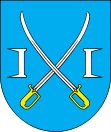
- Tłuchowo
-
Tłuchowo 
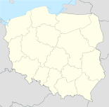
Basisdaten Staat: Polen Woiwodschaft: Kujawien-Pommern Landkreis: Lipno Geographische Lage: 52° 45′ N, 19° 28′ O52.7519.466666666667Koordinaten: 52° 45′ 0″ N, 19° 28′ 0″ O Einwohner: 1159 (2006)
Postleitzahl: 87-605 Telefonvorwahl: (+48) 54 Kfz-Kennzeichen: CLI Gemeinde Gemeindeart: Landgemeinde Gemeindegliederung: 20 Schulzenämter Fläche: 98,7 km² Einwohner: 4606
(31. Dez. 2010) [1]Bevölkerungsdichte: 47 Einw./km² Gemeindenummer (GUS): 0408082 Verwaltung Gemeindevorsteher: Krzysztof Roman Dąbkowski Adresse: ul. Sierpiecka 20
87-605 TłuchowoWebpräsenz: www.tluchowo.com.pl Tłuchowo (deutsch 1939–1942 Tluchowo, 1942–1945 Tülchau) ist ein Dort und Sitz der gleichnamigen Landgemeinde in Polen. Der Ort liegt im Powiat Lipnowski der Wojewodschaft Kujawien-Pommern.
Gemeinde
Zur Landgemeinde Tłuchowo gehören 20 Ortsteile (deutsche Namen bis 1945)[2][3] mit einem Schulzenamt.
- Borowo (1939–1942 Borowo, 1942–1945 Barau)
- Jasień (1939–1942 Jasen, 1942–1945 Lichtenbach)
- Julkowo (1939–1942 Julkowo, 1942–1945 Julke)
- Kamień Kmiecy (1939–1942 Kamien-Kmiecy, 1942–1945 Bauernstein)
- Kamień Kotowy (1939–1942 Kamien-Kotowy, 1942–1945 Kattenstein)
- Kłobukowo (1939–1942 Klobukowo, 1942–1945 Heidefeld)
- Koziróg Leśny (1939–1942 Kozirog-Lesny, 1942–1945 Ziegenhorn)
- Koziróg Rzeczny (1939–1942 Kozirog-Rzeczny, 1942–1945 Ziegenhöhe)
- Małomin (1939–1942 Malomin, 1942–1945 Malmen)
- Marianki (1942–1945 Lindengart)
- Mysłakówko (1939–1942 Myslakowko, 1942–1945 Meiselbach)
- Nowa Turza (1939–1942 Neu Turza, 1942–1945 Wolfsried-Räumung)
- Rumunki Jasieńskie (1939–1942 Jasener Rumunki, 1942–1945 Lichten-Räumung)
- Suminek (1942–1945 Saumhütte)
- Tłuchowo (1939–1942 Tluchowo, 1942–1945 Tülchau)
- Tłuchówek (1939–1942 Tluchowko, 1942–1945 Tülchenhof)
- Trzcianka (1939–1942 Tschzianka, 1942–1945 Schanken)
- Turza Wilcza (1939–1942 Wilcza Turza, 1942–1945 Wolfsried)
- Wyczałkowo (1939–1942 Wytschalkow, 1942–1945 Wittelshöhe)
- Źródła (1942–1945 Quellhof)
Weitere Ortschaften der Gemeinde sind Jeżewo, Michałkowo, Mysłakowo (1939–1942 Myslakow, 1942–1945 Meiselfeld), Podole (1939–1942 Podole, 1942–1945 Padels) und Popowo.
Weblinks
- 3282 Tülchau (Topograph. Karte, 1:25000), Deutsche Heereskarte, Ausgabe 1 vom XI. 1944
- Amtsbezirk Tülchau (1939–1945)
Fußnoten
- ↑ Population. Size and Structure by Territorial Division. As of December 31, 2010. Główny Urząd Statystyczny (GUS), abgerufen am 9. Juli 2011.
- ↑ siehe 3282 Tülchau , Deutsche Heereskarte
- ↑ http://www.mapywig.org/m/German_maps/German_WIG/Grossblatt_Nr._339_Soldau.jpg
Kategorien:- Gmina in der Woiwodschaft Kujawien-Pommern
- Ort der Woiwodschaft Kujawien-Pommern
Wikimedia Foundation.

