Church Island (Valentia Harbour)
- Church Island (Valentia Harbour)
-
Vorlage:Infobox Insel/Wartung/Bild fehltVorlage:Infobox Insel/Wartung/Fläche fehltVorlage:Infobox Insel/Wartung/Höhe fehlt
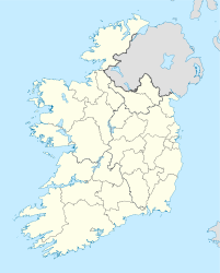
Church Island (irisch: Oileán an Teampaill) ist eine Insel im Valentia Harbour im County Kerry in Irland. Auf der neben Beginish Island gelegenen Insel stand früher ein Kloster, über dessen Geschichte nichts bekannt ist. Es gehörte zur frühesten Form irischer Klöster mit hölzernem Oratorium und einer Rundhütte. Später wurde ein rechteckiges Oratorium aus Stein in Trockenmauerwerk-Technik errichtet, vergleichbar dem berühmten Gallarus Oratory. Auch die Rundhütte und ein weiterer rechteckiger Bau wurden aus Stein mit einem Strohdach errichtet. In späterer Zeit wurde der gesamte Komplex von einem Peribolos eingefasst. Ein Kreuzstein mit einer Ogam-Inschrift wurde bei der Ausgrabung gefunden. Die Kirche soll aus dem Jahre 750 n. Chr. oder aus späterer Zeit stammen.
Literatur
Wikimedia Foundation.
Schlagen Sie auch in anderen Wörterbüchern nach:
Church Island — ist der Name mehrerer Inseln im englischen Sprachraum: Church Island (Menai Straße), Wales Church Island (Lough Gill), Binneninsel in Irland Church Island (Valentia Harbour), Irland Church Island (Lough Beg), Binneninsel in Irland Church Island… … Deutsch Wikipedia
Liste der Britischen Inseln — Lage der Britischen Inseln Diese Liste führt die wichtigsten der etwa 600 Inseln der Britischen Inseln auf. Politisch sind diese Inseln Teil des Vereinigten Königreichs, der Republik Irland und der Isle of Man, die als Kronbesitz kein Bestandteil … Deutsch Wikipedia
County Kerry — Contae Chiarraí Karte Basisdaten Staat: Irland Verwaltungssitz: Tralee Provinz … Deutsch Wikipedia
Kirkcudbright — 1) KIRKCUDBRIGHT, a royal burgh and a parish, in the stewartry of Kirkcudbright, of which it is the capital, 28 miles (S. W. by W.) from Dumfries, and 100 (S. W.) from Edinburgh; containing 3526 inhabitants, of whom 2692 are in the burgh. This … A Topographical dictionary of Scotland
Glasgow — GLASGOW, a city, the seat of a university, and a sea port, having separate jurisdiction, locally in the Lower ward of the county of Lanark, and situated in longitude 4° 15 51 (W.), and latitude 55° 52 10 (N.), 23 miles (E. by S.) from Greenock … A Topographical dictionary of Scotland
List of communities in Ontario — Communities in the province of Ontario, Canada Note: this is an incomplete list of communities, not necessarily organized municipalities. For organized municipalities see list of municipalities in Ontario and for census subdivisions see list of… … Wikipedia
Diffusion of technology in Canada — This article outlines the history of the diffusion or spread of technology in Canada. Technologies chosen for treatment here include, in rough order, transportation, communication, energy, materials, industry, public works, public services… … Wikipedia
Technological and industrial history of Canada — The technological and industrial history of Canada encompasses the country s development in the areas of transportation, communication, energy, materials, public works, public services (health care), domestic/consumer and defense technologies.… … Wikipedia
Dingle — This article is about the town in Ireland. For other uses, see Dingle (disambiguation). Dingle an Daingean / Daingean Uí Chúis Town … Wikipedia
Currow — An Currach / Corra Town … Wikipedia