De Doorns

De Doorns
De Doorns
De Doorns (Westkap)
De Doorns
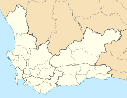
De Doorns
Basisdaten
Staat Südafrika
Provinz Westkap
Distrikt Kapweinland
Gemeinde Breede Valley
Höhe 460 m
ISO 3166-2 ZA-WC
-33.48333119.666663

De Doorns ist eine Stadt mit rund 26.455 Einwohnern in der Gemeinde Breede Valley, Distrikt Kapweinland, Provinz Westkap in Südafrika. Die Stadt liegt im Hex-River Tal in 460 Meter Höhe an der N1-Autobahn, die Kapstadt und Johannesburg verbindet. Worcester liegt 34 Kilometer südwestlich und Touwsrivier 40 Kilometer nordöstlich.

Geschichte

1875 wurde auf der Farm De Doorns (afrikaans für: die Dornen, der Name bezieht sich auf die Akazien am Ufer des Hex-River) eine Eisenbahnstation errichtet, die in Laufe der Jahre zu einer Stadt anwuchs.

Bekannt ist der Ort für eine romantische südafrikanische Legende: Die Buffelskraal-Farm (heutiger Name: Clovelly) war der Geburtsort von Eliza Meiring, einem hübschen Mädchen. Um ihre Freier 1786 zu testen, sollten diese ihr vom nahegelegenen 2.249 Meter hohen Matroosberg eine Disa (Orchidee) mitbringen. Der junge Mann, den sie bevorzugte, machte sich auf den Weg, stolperte jedoch und stürzte am Berg zu Tode. Als Eliza davon erfuhr, wurde sie geistesgestört und wurde auf ihrem Zimmer im Obergeschoss eingeschlossen. Bei ihrem Versuch ein Fenster zu öffnen, stolperte sie ebenfalls und kam zu Tode.

Weblinks und Quellen


Wikimedia Foundation.

Игры ⚽ Поможем сделать НИР

Schlagen Sie auch in anderen Wörterbüchern nach:

  • De Doorns — De Doorns, Western Cape Country  South Africa Province Western Cape District municipality Cape Winelands …   Wikipedia

  • Worcester, Western Cape — Worcester   Town   Top: Dutch Reformed Church. Center left: Slave bell. Center right: Old house on Russell Street built in 1836. Bottom: View of Worcester looking north east …   Wikipedia

  • Breede Valley Local Municipality — Zamuni code= WC025 location= Cape Winelands District Municipality, Western Cape Province area= 2.994 neighbours= mayor=Charles Ntsomi (ANC) population= 146,029 population density= habitations= habitation density= races= Black African : 20.13%… …   Wikipedia

  • Vehicle registration plates of South Africa — South African number plates are unique in each of the provinces. Each province has their own number plate design and colours, as well as numbering scheme.The nine provincesKey: * UPPER CASE LETTERS: Literal letters in the numberplate * a:… …   Wikipedia

  • Paarl —   Town   Paarl from Paarl Mountain, with the Drakenstein Mountains beyond …   Wikipedia

  • Stellenbosch — This article is about the town. For the university, see Stellenbosch University. For the municipality, see Stellenbosch Local Municipality. Stellenbosch   Town   Nickname(s): Eikestad, Matiestad, Matieland …   Wikipedia

  • N1 road (South Africa) — National Route N1 Route information …   Wikipedia

  • List of cities and towns in the Western Cape — This is a list of cities and towns in the Western Cape Province of South Africa.The Cape MetropoleSee List of Cape Town suburbsThe Winelands* Franschhoek * Paarl * StellenboschSuburbs of Stellenbosch::* Brandwacht:* Cloetesville:* Dalsig:* Die… …   Wikipedia

  • Drakenstein Local Municipality — Drakenstein Plaaslike Munisipaliteit UMasipala weNgingqi yaseDrakenstein   Local municipality   …   Wikipedia

  • List of heraldic charges — This article does not cover those charges which derive their shape in part from that of the field; see Ordinary (heraldry). Subordinary chargesA few simple charges are traditionally, and arbitrarily, classified among the subordinaries. (All other …   Wikipedia

Share the article and excerpts

Direct link
Do a right-click on the link above
and select “Copy Link”