Eunola

Eunola
Eunola
Geneva County Alabama Incorporated and Unincorporated areas Eunola Highlighted.svg
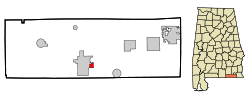
Lage im County und in Alabama
Basisdaten
Staat: Vereinigte Staaten
Bundesstaat: Alabama
County:

Geneva County

Koordinaten: 31° 2′ N, 85° 51′ W31.038611111111-85.84666666666742Koordinaten: 31° 2′ N, 85° 51′ W
Zeitzone: Central Standard Time (UTC−6)
Einwohner: 184 (Stand: 2005)
Bevölkerungsdichte: 76,7 Einwohner je km²
Fläche: 2,4 km² (ca. 1 mi²)
davon 2,4 km² (ca. 1 mi²) Land
Höhe: 42 m
Postleitzahl: 36340
Vorwahl: +1 334
FIPS: 01-24616
GNIS-ID: 0118055

Eunola ist ein Ort im Geneva County, Alabama, USA. Die Gesamtfläche des Ortes beträgt 2,5 km². Nach einer Schätzung aus dem Jahr 2005 hat das Dorf 184 Einwohner.

Demographie

Bei der Volkszählung aus dem Jahr 2000 hatte Eunola 182 Einwohner, die sich auf 87 Haushalte und 56 Familien verteilten. Die Bevölkerungsdichte betrug somit 74,8 Einwohner/km². 89,56% der Bevölkerung waren weiß, 8,79% afroamerikanisch. In 28,7% der Haushalte lebten Kinder unter 18 Jahren. Das Durchschnittseinkommen betrug 26250 Dollar pro Haushalt, wobei 14,6% der Bevölkerung unterhalb der Armutsgrenze lebten.

Quelle

Webseite des U.S. Census Bureau (englisch)


Wikimedia Foundation.

Игры ⚽ Нужно сделать НИР?

Schlagen Sie auch in anderen Wörterbüchern nach:

  • Eunola — Eunola, AL U.S. town in Alabama Population (2000): 182 Housing Units (2000): 97 Land area (2000): 0.944088 sq. miles (2.445176 sq. km) Water area (2000): 0.019161 sq. miles (0.049626 sq. km) Total area (2000): 0.963249 sq. miles (2.494802 sq. km) …   StarDict's U.S. Gazetteer Places

  • Eunola, AL — U.S. town in Alabama Population (2000): 182 Housing Units (2000): 97 Land area (2000): 0.944088 sq. miles (2.445176 sq. km) Water area (2000): 0.019161 sq. miles (0.049626 sq. km) Total area (2000): 0.963249 sq. miles (2.494802 sq. km) FIPS code …   StarDict's U.S. Gazetteer Places

  • Eunola, Alabama — Infobox Settlement official name = Eunola, Alabama settlement type = Town imagesize = image caption = image imagesize = image caption = image mapsize = 250px map caption = Location in Geneva County and the state of Alabama mapsize1 = map caption1 …   Wikipedia

  • Liste der wichtigsten Städte in Alabama — Abbeville Abel Abernant Ada Adamsville Addison Adger Akron Alabama Port Alabaster Alberta Albertville Alexander City Alexandria Aliceville Allgood Alma Alpine Alton Altoona Andalusia Anderson Annemanie …   Deutsch Wikipedia

  • Geneva County, Alabama — Infobox U.S. County county = Geneva County state = Alabama map size = 150 founded = December 26, 1868 seat = Geneva | largest city = Geneva area total sq mi =579 area land sq mi =576 area water sq mi =3 area percentage = 0.45% census yr = 2000… …   Wikipedia

  • Coffee Springs, Alabama —   Town   Welcome sign in Coffee Springs …   Wikipedia

  • Malvern, Alabama —   Town   Location in …   Wikipedia

  • Alabama locations by per capita income — Alabama has the thirty eighth highest per capita income in the United States of America, at $18,189 (2000). Its personal per capita income is $26,338 (2003), the fortieth highest in the country. Its median household income is $34,135 (2000),… …   Wikipedia

  • Dothan metropolitan area — The Dothan Metropolitan Statistical Area, as defined by the United States Census Bureau, is an area consisting of three counties in southeastern Alabama, anchored by the city of Dothan. As of the 2000 census, the MSA had a population of 130,861… …   Wikipedia

  • Geneva County — Verwaltung US Bundesstaat: Alabama Verwaltungssitz: Geneva Adresse des Verwaltungssitzes: County Courthouse P.O. Box 430 Geneva, AL 36340 0430 Gründung: 26. Dezember 1868 …   Deutsch Wikipedia

Share the article and excerpts

Direct link
Do a right-click on the link above
and select “Copy Link”