- Akatarawa River
-
Akatarawa River 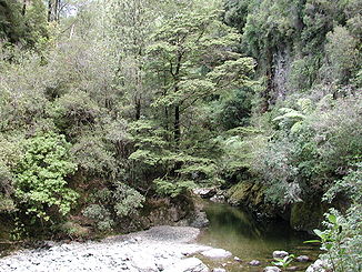
Akatarawa River in der Karapoti Schlucht
Daten Lage Nordinsel Neuseelands Flusssystem Hutt River Mündung bei Upper Hutt in den Hutt River -41.090351175.097657Koordinaten: 41° 5′ 25″ S, 175° 5′ 52″ O
41° 5′ 25″ S, 175° 5′ 52″ O-41.090351175.097657Länge 20 km Der Akatarawa River ist ein Fluss im Süden der Nordinsel Neuseelands. Er fließt durch kleine Felsschluchten und durch das Akatarawa Valley, bevor er am Nordende von Upper Hutt nach insgesamt 20 Kilometern in den Hutt River mündet, der sein Wasser in den Wellington Harbour ableitet.
Kategorien:- Fluss in Neuseeland
- Wellington (Region)

Wikimedia Foundation.