Garbahaarreey — Infobox Settlement official name = Garbahaarreey other name = native name = nickname = settlement type = motto = imagesize = 300px image caption = flag size = image seal size = image shield = shield size = image blank emblem = blank emblem type … Wikipedia
Gedo — ( so. Geedo ) is an administrative region ( gobolka ) formerly part of the historic Upper Juba Region, Somalia. Gedo regional capital is Garbahaarreey. Gedo is a region created in 1980 s and is bordered by the Ogaden, the North Eastern Province,… … Wikipedia
Gobolka — Karte der Regionen Somalias Rot: Mogadischu, Rosa: Somaliland, Blau: Puntland, Grün: Südwestsomalia/Jubaland, Grau: Zentralsomalia Die Verwaltungsgliederung Somalias ist nach Regionen (Gobol ka, Plural Gobolada) eingeteilt. Die Regionen sind… … Deutsch Wikipedia
Siad Barre — محمد زياد بري Siyaad Barre Military portrait of Major General Mohamed Siad Barre. 3rd President of Somalia In office October 21, 1969 – January 26, 1991 Vice President … Wikipedia
Verwaltungsgliederung Somalias — Karte der Regionen und Distrikte Somalias Die offizielle Verwaltungsgliederung Somalias, die in ihrer zuletzt gültigen Form 1974 eingeführt wurde, teilt das Land in 18 Regionen ein (Plural Gobolada, Singular Gobol ka), die ihrerseits in Distrikte … Deutsch Wikipedia
List of cities in Somalia — This is a list of cities and towns in Somalia. *Afbarwaaqo *Afgooye *Afmadow *Ainabo *Arabsiyo *Baidoa *Balad *Bandar Beyla *Bandiiradley *Barawa (Baraawe) *Bardera (Baardheere) *Beledhawo *Beledweyne *Berbera *Bitaale *Boorama *Bosaso (Boosaaso) … Wikipedia
States and regions of Somalia — Five quasi independent macro regions have formed in Somalia since the 1990s. These entities and their capitals are:) ) ) ) )The regions of Somalia have been correspondingly changed by these entities. Somalia *Transitional Federal Government: **… … Wikipedia
Shilavo — Infobox Settlement official name = Shilavo other name = native name = nickname = settlement type = motto = imagesize = image caption = flag size = image seal size = image shield = shield size = city logo = citylogo size = mapsize = map caption =… … Wikipedia
Bardera — Infobox Settlement official name = Bardera other name = native name = Baardheere nickname = settlement type = motto = imagesize = 300px image caption = Bardera: Looking Towards The Arc flag size = image seal size = image shield = shield size =… … Wikipedia
Districts of Somalia — | Politics of SomaliaBefore the civil war began in 1991, the regions of Somalia were subdivided into 75 districts. These districts are listed below, by region: =Awdal Region= *Dilla *Baki *Borama *Lughaya *Saylac =Bakool Region= *Hudur *Rabdhure… … Wikipedia
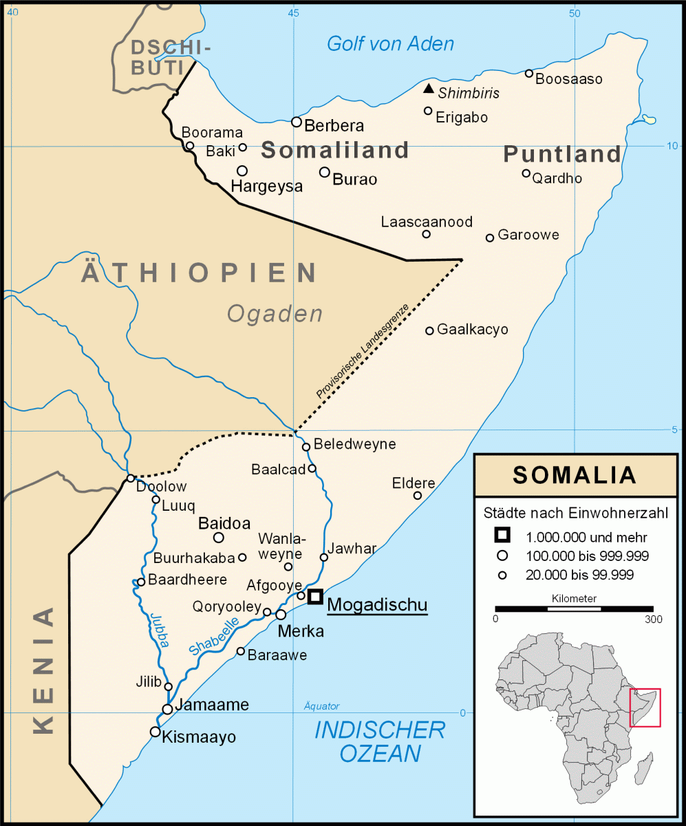 Karte Somalias; Garbahaarrey liegt südwestlich von Luuq