- Hlboke
-
Hlboké
Wappen Karte 

Hlboké BasisdatenLandschaftsverband (Kraj): Trnavský kraj Bezirk (Okres): Senica Region: Záhorie Fläche: 20,212 km² Einwohner: 918 (31. Dezember 2005) Bevölkerungsdichte: 45,42 Einwohner je km² Höhe: 247 Meter Postleitzahl: 906 31 Telefonvorwahl: 0 34 Geographische Lage: 48° 40′ N, 17° 25′ O48.66388888888917.411111111111247Koordinaten: 48° 39′ 50″ N, 17° 24′ 40″ O Kfz-Kennzeichen: SE Gemeindekennziffer: 504360 StrukturGemeindeart: Gemeinde Verwaltung (Stand: Januar 2008)Bürgermeister: Pavol Holejšovský Adresse: Obecný úrad Hlboké
114
90631 HlbokéWebpräsenz: www.hlboke.sk Gemeindeinformation
auf portal.gov.skStatistikinformation
auf statistics.skHlboké (bis 1927 slowakisch auch „Hluboké“; ungarisch Luboka - bis 1907 Hluboka) ist eine Gemeinde in der Westslowakei. Sie liegt in der Landschaft Záhorie, 4 km von Senica und etwa 35 km von Trnava entfernt.
Die Gemeinde wurde 1262 erstmals schriftlich erwähnt. 1843 wurde hier im Ort die Kodifizierung der Slowakischen Sprache unter maßgeblichen Einfluss von Ľudovít Štúr beschlossen.
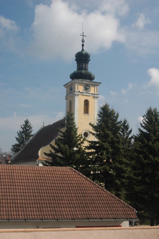
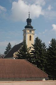 Evangelische Kirche von 1787
Persönlichkeiten
- Jozef Miloslav Hurban, slowakischer Politiker, lebte und starb in Hlboké
- Svetozár Hurban Vajanský, slowakischer Schriftsteller, geboren in Hlboké
Weblinks
Gemeinden im Okres SenicaBílkove Humence | Borský Mikuláš (Bursanktnikolaus) | Borský Svätý Jur (Bursanktpeter) | Cerová | Čáry | Častkov | Dojč (Deutz) | Hlboké | Hradište pod Vrátnom (Hradisch) | Jablonica (Jablonitz) | Koválov (Kowallow) | Kuklov (Kugelhof) | Kúty (Kutti) | Lakšárska Nová Ves (Laxarneudorf) | Moravský Svätý Ján (Sankt Johann an der March) | Osuské | Plavecký Peter (Blasensteinsanktpeter) | Podbranč (Podbrantsch) | Prietrž | Prievaly (Schandorf) | Rohov | Rovensko (Rabenskahof) | Rybky | Sekule (Sekeln) | Senica (Senitz) | Smolinské | Smrdáky | Sobotište (Sobotischt) | Šajdíkove Humence | Šaštín-Stráže | Štefanov


Wikimedia Foundation.