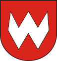
- Krośniewice
-
Krośniewice 
Basisdaten Staat: Polen Woiwodschaft: Łódź Landkreis: Kutno Fläche: 2,96 km² Geographische Lage: 52° 15′ N, 19° 10′ O52.2519.166666666667Koordinaten: 52° 15′ 0″ N, 19° 10′ 0″ O Einwohner: 4554
(31. Dez. 2010)[1]Postleitzahl: 99-340 Telefonvorwahl: (+48) 24 Wirtschaft und Verkehr Straße: Łódź–Toruń Warschau–Posen Nächster int. Flughafen: Flughafen Łódź Gemeinde Gemeindeart: Stadt und Landgemeinde Fläche: 95 km² Einwohner: 8829
(31. Dez. 2010) [2]Bevölkerungsdichte: 93 Einw./km² Gemeindenummer (GUS): 1002043 Verwaltung (Stand: 2007) Bürgermeisterin: Julianna Herman Adresse: ul. Poznańska 5
99-340 KrośniewiceWebpräsenz: krosniewice.pl Krośniewice [krɔɕɲɛˈvʲitsɛ] (1943–45 Kroßwitz) ist eine Stadt im Powiat Kutnowski in der Wojewodschaft Łódź, Polen. Die Stadt ist gleichzeitig Sitz der gleichnamigen Stadt- und Landgemeinde.
Inhaltsverzeichnis
Geografie
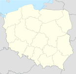
Krośniewice liegt 59 km nördlich von Łódź und 15 Kilometer westlich von der Kreisstadt Kutno. In der Stadt kreuzen sich die Droga krajowa 1 und die Droga krajowa 92.
Geschichte
Die erste Erwähnung einer Siedlung an der Stelle des heutigen Krośniewice stammt aus dem Jahr 1387, in dem der Ort bereits eine Pfarrkirche besaß. Die genaue Vergabe des Stadtrechts an den Ort ist nicht bekannt, es wird allerdings davon ausgegangen, dass es vor 1442 war.
1567 zerstörte ein Brand nahezu die gesamte Stadt. Während der Zweiten Teilung Polens kam der Ort unter preußische Herrschaft. Mit der Bildung des Herzogtums Warschau wurde Krośniewice 1807 Teil desselben und 1815 Teil Kongresspolens. 1870 verlor der Ort sein Stadtrecht. Mit Ende des Ersten Weltkrieges wurde der Ort wieder Teil Polens und erhielt 1926 sein Stadtrecht zurück.
Bei einer Verwaltungsreform wurde die Stadt 1975 Teil der Woiwodschaft Płock, bei einer erneuten Reform kam sie 1999 zur Woiwodschaft Łódź.
Persönlichkeiten
- Władysław Anders, (* 1892 in Krośniewice-Błonie, † 1970 in London), polnischer General
Gemeinde
Geographie
Die Gemeinde hat eine Flächenausdehnung von 94,65 km². 89 % des Gemeindegebiets werden landwirtschaftlich genutzt, 3 % sind mit Wald bedeckt.[3]
Sołectwo
Zur Gemeinde gehören Schulzenämter (Sołectwo) Bielice (1943–1945 Raudenhof[4]), Franki (1943–1945 Frankdorf[4]), Jankowice, Kajew, Kopy, Luboradz, Morawce, Nowe, Ostałów, Pawlikowice, Pomarzany, Suchodoły, Szubina, Szubsk Duży, Szubsk-Towarzystwo, Teresin, Witów, Wola Nowska, Wychny, Wymysłów, Zalesie, Zieleniew. Sowie die Ortschaften Bardzinek, Błonie, Cudniki, Cygany, Głaznów 1943–1945 Fohlenbach[4]), Głogowa, Godzięby, Górki Miłońskie, Iwiczna, Kopyta, Krzewie, Marynin, Miłonice (1943–1945 Millnitz[4]), Miłosna, Nowe Jankowice, Pniewko, Raszynek, Rozpacz, Skłóty, Stara Wieś, Stare Morawce,Tumidaj, Zosin.
Verweise
Weblinks
-
 Commons: Krośniewice – Sammlung von Bildern, Videos und Audiodateien
 - Offizielle Website der Stadt
- Website des Museums
Fußnoten
- ↑ Population. Size and Structure by Territorial Division. As of December 31, 2010. Główny Urząd Statystyczny (GUS), abgerufen am 16. Juli 2011.
- ↑ Population. Size and Structure by Territorial Division. As of December 31, 2010. Główny Urząd Statystyczny (GUS), abgerufen am 16. Juli 2011.
- ↑ regioset.pl (polnisch, abgerufen 13. Juli 2010)
- ↑ a b c d Quelle: Deutsche Heereskarte, Europa 1:300 000, Q 52 Litzmannstadt, Ausgabe Nr. 3, Druck XII 1944, Folie D/414
Kategorien:- Gmina in der Woiwodschaft Łódź
- Ort der Woiwodschaft Łódź
Wikimedia Foundation.


