Kyyjärvi (See)

Kyyjärvi (See)
Kyyjärvi

Photo-request.svg

Bild gesucht 

BW

Geographische Lage Kyyjärvi, Mittelfinnland
Abfluss Oikarinjoki → Kiminginjärvi → Kiminginjoki → Pääjärvi → Heijostenkoski → Tuhmalampi → Tuhmajoki → Kalmarinselkä → Kalmujoki → Vartejärvi → Mahlunjärvi → Saarijärvi → Leuhunjoki → Summainen → Kiimsajärvi → Suojoki → Naarajärvi → Kuhjamo → Vatianjärvi → Saraavesi → Leppävesi → Päijänne
Daten
Koordinaten 63° 3′ 30″ N, 24° 35′ 20″ O63.05833333333324.588888888889150Koordinaten: 63° 3′ 30″ N, 24° 35′ 20″ O
Kyyjärvi (Finnland)
Kyyjärvi
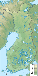
Höhe über Meeresspiegel 150 m
Fläche 16,34 km²f5
Länge 10 kmf6
Breite 3 kmf7

Der Kyyjärvi („Kreuzottersee“) ist ein See in der gleichnamigen Gemeinde Kyyjärvi in Mittelfinnland.

Er bedeckt eine Fläche von rund 16,34 km² im Bereich des Salpausselkä-Höhenrückens auf einer Höhe von 150 m über dem Meeresspiegel und ist somit einer der höchstgelegenen Seen Finnlands (ausschließlich Lapplands). Der längliche See hat eine Ausdehnung von rund 10 km von Nordwesten nach Südosten, an seiner breitesten Stelle ist er rund 3 km breit. Von der Halbinsel Tervaniemi wird er in ein Nord- und ein Südbecken geteilt. Im Winter friert der See gänzlich zu, sodass eine Eisstraße zwischen dem Kirchdorf Kyyjärvi am Südufer des Sees und dem Dorf Pölkki eingerichtet wird. Das Eis des Südbeckens beginnt im Allgemeinen gegen Anfang April aufzutauen.

Die verschilften und zum Teil bewaldeten Ufer des Sees bieten Lebensraum für zahlreiche Vogelarten wie dem seltenen Singschwan.


Wikimedia Foundation.

Игры ⚽ Поможем написать курсовую

Schlagen Sie auch in anderen Wörterbüchern nach:

  • Kyyjärvi — Kyyjärven kunta Wappen Karte Basisdaten …   Deutsch Wikipedia

  • Regions of Western Finland — This article is part of the Subdivisions of Finland series Regions Sub regions Municipalities list list by population list by area NUTS:FI ISO 3166 2:FI The former Province of Western Finland in Finland was divided on seven regions, 34 districts… …   Wikipedia

  • Jyväskylä — Jyväskylän kaupunki Wappen Karte Basisdaten …   Deutsch Wikipedia

  • Karstula — Karstulan kunta Wappen Karte Basisdaten Staat …   Deutsch Wikipedia

  • Siilinjärvi — Siilinjärven kunta Wappen Karte Basisdaten …   Deutsch Wikipedia

  • List of Finnish municipalities — This is a listing in alphabetical order of the current municipalities in Finland as of 2008. For population see List of Finnish municipalities by population. Notice that if the place has both a Finnish and a Swedish name, the majority language is …   Wikipedia

  • Municipalities of Central Finland — This article is part of the Subdivisions of Finland series Regions Sub regions Municipalities list list by population list by area NUTS:FI ISO 3166 2:FI The 23 municipalities of the Central Finland Region in Finland are divided on seven sub… …   Wikipedia

  • Central Finland — (in Finnish Keski Suomi , in Swedish Mellersta Finland ) is a region ( maakunta / landskap ) in the province of Western Finland. It borders to the regions Päijänne Tavastia, Pirkanmaa, Southern Ostrobothnia, Central Ostrobothnia, Northern… …   Wikipedia

  • Multia, Finland — Multia redirects here. For the computer workstation, see DEC Multia. Multia   Municipality   Multian kunta …   Wikipedia

  • Konnevesi — Konneveden kunta Wappen Karte Basisdaten Staat …   Deutsch Wikipedia

Share the article and excerpts

Direct link
Do a right-click on the link above
and select “Copy Link”