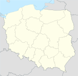
Lambinowice

Lambinowice
Łambinowice
Wappen von Łambinowice (Lamsdorf)
Łambinowice (Polen)
DEC
Łambinowice
Łambinowice
Basisdaten
Staat: Polen
Woiwodschaft: Oppeln
Landkreis: Nysa
Geographische Lage: 50° 32′ N, 17° 33′ O50.53847222222217.5540555555567Koordinaten: 50° 32′ 18″ N, 17° 33′ 15″ O
Einwohner: 2.800 (31. Dezember 2004)
Postleitzahl: 48-316
Telefonvorwahl: (+48) 77
Kfz-Kennzeichen: ONY
Wirtschaft und Verkehr
Nächster int. Flughafen: Flughafen Kattowitz
Gemeinde
Gemeindeart: Landgemeinde
Fläche: 123,7 km²
Einwohner: 7.882 (31. Januar 2006)
Verwaltung (Stand: )
Adresse: ul. generała Zawadzkiego 29
48-316 Łambinowice
Webpräsenz: www.lambinowice.pl

Łambinowice (deutsch Lamsdorf) ist eine Landgemeinde in der Woiwodschaft Oppeln im südwestlichen Teil Polens und gehört zum Landkreis Nysa.

Geschichte

Historische Bedeutung erlangte das Dorf durch das Stalag VIII B (344) Lamsdorf, das von 1939 bis 1945 als eines der größten deutschen Kriegsgefangenenlager betrieben wurde und vom 18. Juni 1945 bis Herbst 1946 als Konzentrationslager im Rahmen der Vertreibung der Deutschen aus Oberschlesien diente. Ein erheblicher Teil der Lagerinsassen kam dabei um. Das Lager befand sich auf dem Gelände des Truppenübungsplatzes Lamsdorf.


Wikimedia Foundation.

Игры ⚽ Поможем сделать НИР

Schlagen Sie auch in anderen Wörterbüchern nach:

  • Lambinowice — Original name in latin ambinowice Name in other language Lambinowice, Lamsdorf, ambinowice State code PL Continent/City Europe/Warsaw longitude 50.53869 latitude 17.56096 altitude 204 Population 2800 Date 2010 09 25 …   Cities with a population over 1000 database

  • Lambinowice — 50°32′N 17°34′E / 50.533, 17.567 Le camp de prisonniers de Lamsdorf était situé en Haute Silésie en All …   Wikipédia en Français

  • Гмина Ламбиновице — Gmina Łambinowice Герб Файл:Gmina lambinowice.jpg Страна:  Польша Повят:  Ныский повят Глава:  Томаш Карпиньски (2012) Площадь:  123,71 км² Население:  8264 чел …   Википедия

  • Łambinowice — Infobox Settlement official name = Łambinowice other name = native name = Łambinowice nickname = settlement type = Village motto = imagesize = image caption = flag size = image seal size = image shield = COA Lambinowice.jpg shield size = 100px… …   Wikipedia

  • Stalag VIII-B — Lamsdorf was a notorious German Army prisoner of war camp, later renumbered Stalag 344. Located near the small town of Lamsdorf (now called Łambinowice) in Silesia. The camp initially occupied barracks built to house British and French prisoners… …   Wikipedia

  • Lamsdorf — Łambinowice …   Deutsch Wikipedia

  • History of Germany since 1945 — As a consequence of Germany s defeat in World War II and the onset of the Cold War, the country was split between the two global blocs in the East and West. Germany would not be reunited until 1990. The division of GermanyFour occupation zones [… …   Wikipedia

  • Oflag VI-B — Dössel (Doessel) was a World War II German POW camp for officers located 5 km (3.1 mi) SW of the small town Dössel (now part of Warburg) in north western Germany. Contents 1 Timeline 2 Aftermath 3 Notable inmates …   Wikipedia

  • Gmina Łambinowice — Infobox Settlement name = Gmina Łambinowice other name = Łambinowice Commune settlement type = Gmina total type = Total image shield = subdivision type = Country subdivision name = POL subdivision type1 = Voivodeship subdivision name1 = Opole… …   Wikipedia

  • Korfantow — Korfantów …   Deutsch Wikipedia

Share the article and excerpts

Direct link
Do a right-click on the link above
and select “Copy Link”