Loma Prieta

Loma Prieta

f1pd1pd5

Loma Prieta
Höhe 1.155 m
Lage Santa Clara County, Kalifornien
Gebirge Santa Cruz Mountains
Dominanz 30,5 km → Mount Hamilton
Schartenhöhe 1.044 mfd2fd3
Geographische Lage 37° 6′ 40″ N, 121° 50′ 39″ W37.111111111111-121.844166666671155Koordinaten: 37° 6′ 40″ N, 121° 50′ 39″ W
Loma Prieta (Kalifornien)
Loma Prieta

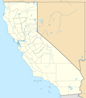
Loma Prieta ist ein Berg im kalifornischen Santa Clara County. Mit 1155 m[1] Höhe ist er der höchste Berg der Santa Cruz Mountains an der Pazifikküste. Sein Name kommt aus dem Spanischen und bedeutet etwa „Dunkler Hügel“. Der Gipfel ist über eine unbefestigte Straße erreichbar und Standort zahlreicher Sendeanlagen. Vom Loma Prieta aus entdeckte der Amateurastronom Don Edward Machholz mehrere Kometen, darunter 96P/Machholz. [2]

Nach dem Loma Prieta wurde das Loma-Prieta-Erdbeben 1989 benannt. Dessen Epizentrum befand wenige Kilometer vom Berggipfel entfernt.[3]

Einzelnachweise

  1. NGS Data Sheet National Geodetic Survey (englisch)
  2. Gary W. Kronk's Cometography (englisch)
  3. Significant Earthquake: California, Loma Prieta National Oceanic and Atmospheric Administration (englisch)

Wikimedia Foundation.

Игры ⚽ Нужно сделать НИР?

Schlagen Sie auch in anderen Wörterbüchern nach:

  • Loma Prieta — Infobox Mountain Name = Loma Prieta Photo = Caption = Elevation = 3,786 feet (1,154 metres) Location = California, USA Range = Santa Cruz Mountains Prominence = 3,430 ft (1,045 m) Coordinates = coord|37|6.67|N|121|50.65|W|type:mountain… …   Wikipedia

  • Loma-Prieta-Erdbeben — Cypress Viadukt nach dem Erdbeben Abgebrochenes Teilstück der San Francisco Oakland Bay Bridge als Folge des Bebens …   Deutsch Wikipedia

  • Loma-Prieta-Erdbeben 1989 — Cypress Viadukt nach dem Erdbeben Abgebrochenes Teilstück der …   Deutsch Wikipedia

  • 1989 Loma Prieta earthquake — earthquake title= Loma Prieta earthquake date=October 17, 1989 magnitude=6.9 Mw depth=convert|18|km|mi|0 epicenter location=coord|37.04| 121.88) countries affected=United States (San Francisco Bay Area) location=Forest of Nisene Marks State Park …   Wikipedia

  • Séisme de Loma Prieta — Carte de l épicentre et des intensités du séisme. Date 17 octobre 1989 à 17 h …   Wikipédia en Français

  • Tremblement de terre de Loma Prieta — Date 17 octobre 1989 à 17h04, heure locale Magnitude 6,9 Régions Baie de San Francisco, Californie, États Unis Victimes 63 morts, 3 757 blessés …   Wikipédia en Français

  • Tremblement de terre de loma prieta — Date 17 octobre 1989 à 17h04, heure locale Magnitude 6,9 Régions Baie de San Francisco, Californie, États Unis Victimes 63 morts, 3 757 blessés …   Wikipédia en Français

  • Terremoto de Loma Prieta — Fecha 17 de octubre de 1989 Magnitud 6.9 MW …   Wikipedia Español

  • Casa Loma, Santa Clara County, California — Casa Loma along with Loma Chiquita are private roads, in a rural area of Santa Clara County covering over 5,500 acres (22.3 km²) with an unofficial population of 175. Both names are marginalized with Loma Chiquita appearing in the US Geological… …   Wikipedia

  • Cypress Street Viaduct — Cypress Freeway, Nimitz Freeway Route information …   Wikipedia

Share the article and excerpts

Direct link
Do a right-click on the link above
and select “Copy Link”