- Lower River Division
-
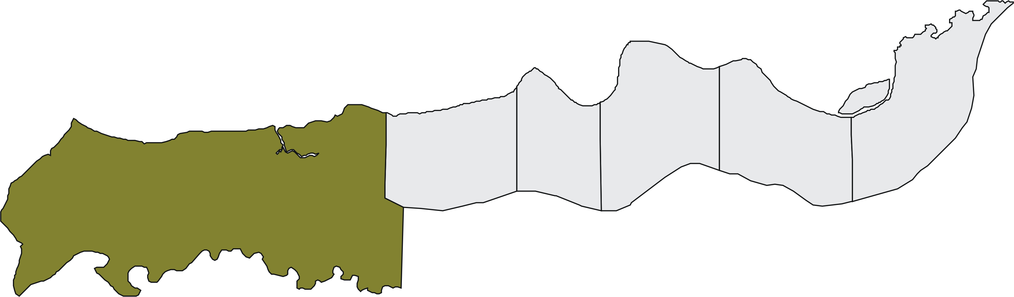
Karte 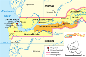 Lage der Division in Gambia
 Lower River
Basisdaten Verwaltungsort Mansa Konko Geographisches Zentrum 13° 24' N, 15° 42' W Koordinaten: 13° 24' N, 15° 42' W Nord-Süd-Ausdehnung 34 km Ost-West-Ausdehnung 113 km Fläche 1.618 km² Einwohnerzahl 74.580 (Stand 2008) Bevölkerungsdichte 46 Einwohner/km² ISO 3166-2 GM-LTelefonvorwahl +220 (5)  Jarra Central
 Jarra East
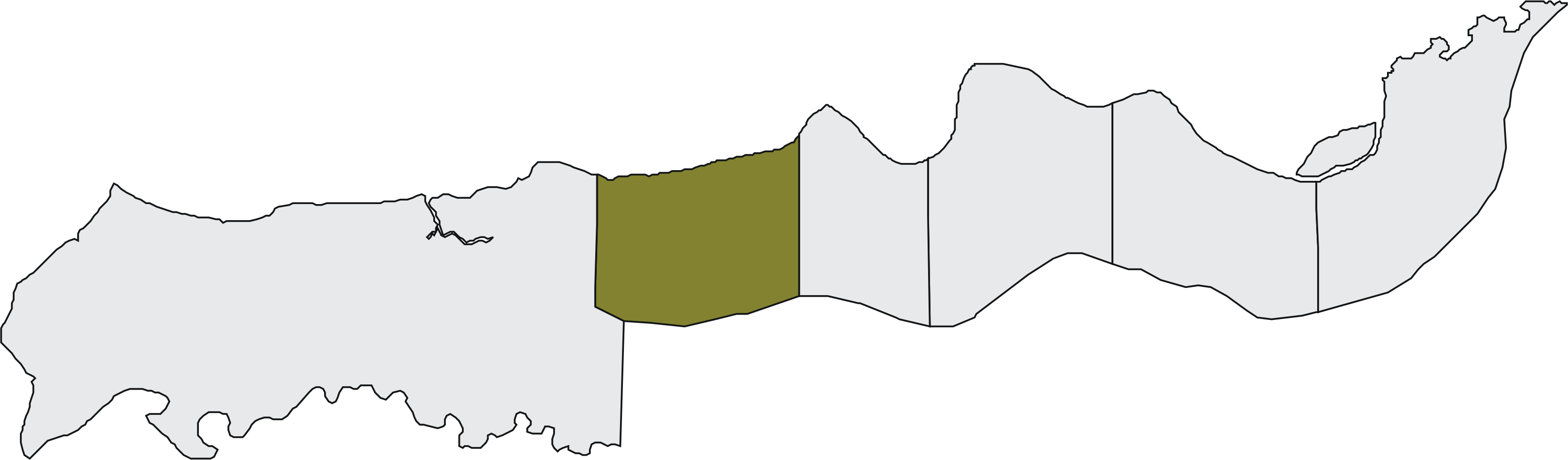
 Jarra West
 Kiang Central
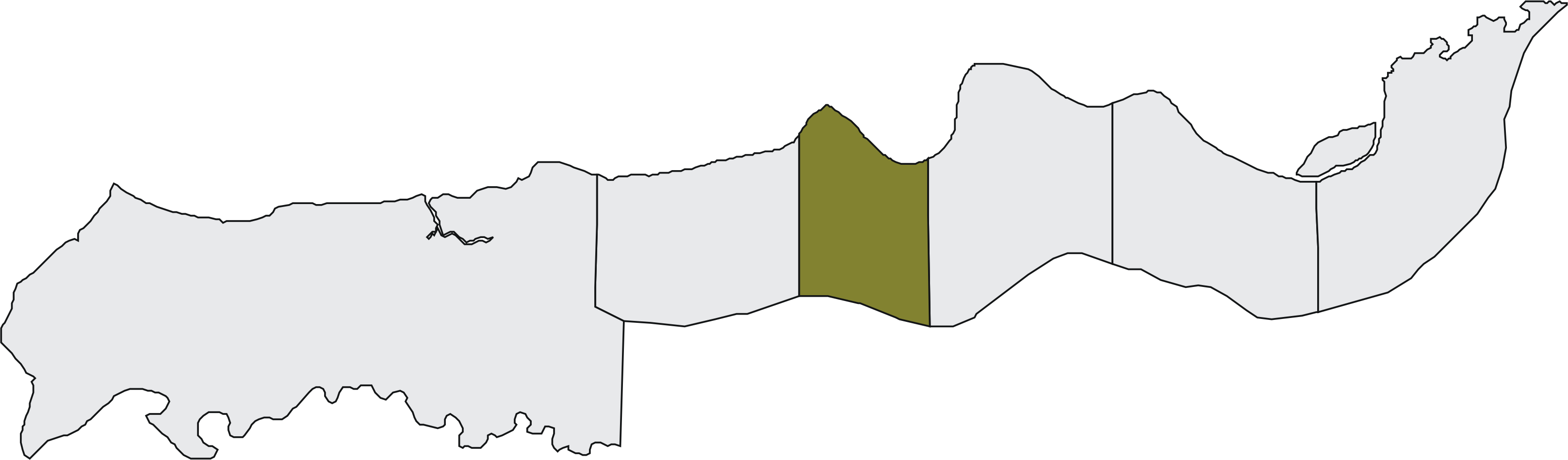
 Kiang East
 Kiang West
Die Lower River Division ist eine von sechs Verwaltungseinheiten (Division) in Gambia.
Inhaltsverzeichnis
Geographie
Die 1.618 km² große Division, mit dem Verwaltungs-Hauptort Mansa Konko mit 315 Einwohnern, ist unterteilt in sechs Distrikte. Mit 74.580 Einwohnern (Schätzung 2008)[1] ist es die dünnste besiedelste Division von Gambia. Die Division erstreckt sich südlich des Gambia-Flusses im Westen von der Western Division bis zur Central River Division im Osten. Der größte Ort mit 10.134 Einwohnern ist Soma, im Distrikt Jarra West, in der Nähe von Mansa Konko.
Orte
Die zehn größten Orte sind:
- Soma, 10.134
- Baro Kunda, 2.125
- Sankwia, 1.988
- Toniataba, 1.906
- Kaiaf, 1.900
- Keneba, 1.886
- Nioro, 1.855
- Sutukung, 1.607
- Wellingara Ba, 1.576
- Bureng, 1.571
- siehe auch Liste der Städte in Gambia
Einwohnerentwicklung
Jahr Einwohnerzahl 1963 34.227 1973 42.447 1983 55.263 1993 65.146 2003 72.546 2005 73.474 2006 73.890 2007 74.280 2008 74.580 
Geschichte
In der älteren Einteilung Gambias, in acht Local Government Areas (LGA), ist die Lower River Division unverändert. Die LGAs existieren parallel, haben aber nicht die Bedeutung wie die Divisionen, da sie keine Codierung nach ISO 3166-2 haben.
Im Jahre 1968 wurde die North Bank Division von der ehemaligen Lower River Division abgespalten.
Distrikte
Distrikt Fläche Bevölkerung Bevölkerungsdichte Kiang West 725 km² 14.974 Einwohner 21 Einwohner/km² Kiang Central 175 km² 8.000 Einwohner 46 Einwohner/km² Jarra East 125 km² 12.829 Einwohner 103 Einwohner/km² Jarra West 201 km² 25.766 Einwohner 128 Einwohner/km² Jarra Central 180 km² 6.544 Einwohner 36 Einwohner/km² Kiang East 212 km² 6.467 Einwohner 31 Einwohner/km² Namensvarianten
Name Varianten Division Lower River Division LGA Mansakonko Stadt Nioro Nioro Jataba, Nioro Tukulorr, Nioro Ebrima Wori Stadt Wellingara Ba Bureng Korosma Quellen
- ↑ World Gazetteer Zugriff März 2008

Greater Banjul Area | Western Division | North Bank Division | Lower River Division | Central River Division | Upper River Division


Wikimedia Foundation.