- Mendota Bridge
-
44.885-93.173611Koordinaten: 44° 53′ 6″ N, 93° 10′ 25″ W
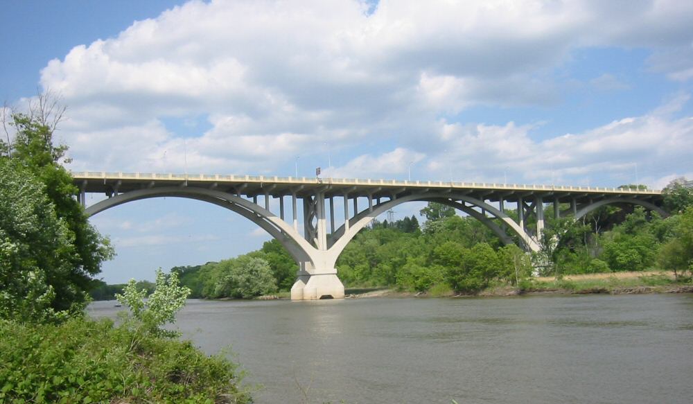
 Mendota BridgeDrei Felder der Mendota Bridge von Westen her gesehen
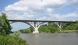
Nutzung Vier Spuren der Minnesota State Route 55 Querung von Minnesota River Ort Metropolregion Minneapolis-Saint Paul Unterhalten durch Minnesota Department of Transportation Bauwerknummer 4190 Konstruktion Bogenbrücke mit 13 Feldern Gesamtlänge 1253,8 m Breite 21,6 m Lichte Höhe 30,5 m Fahrzeuge pro Tag 39.000 Fahrzeuge/Tag Freigabe 1926, 1994 Lage 

Die Mendota Bridge führt die Minnesota State Route 55 über den Minnesota River, zwischen Fort Snelling und Mendota. Es ist die letzte Straßenbrücke über den Minnesota River, bevor dieser an der Stelle in den Mississippi River fließt, die in der Sprache der Dakota „Mendota“ heißt, zu deutsch etwa „Treffen des Wassers“. Am Nordende der Brücke kann der Verkehr zur Fort Road Bridge abbiegen, um dort den Mississippi River in Richtung St. Paul zu überqueren. Bei der Fahrt über die Brücke kann man etwa auf der Mitte gleichzeitig die Silhouette der Twin Cities erkennen.
Geschichte
Das Bauwerk wurde von C.A.P. Turner und Walter H. Wheeler entworfen. Turner hatte auch die Aerial Lift Bridge in Duluth, Minnesota und die Liberty Memorial Bridge zwischen Bismarck und Mandan in North Dakota geplant.
Als die Brücke 1926 erbaut wurde, war es die längste aus Stahlbeton gefertigte Bogenbrücke auf der Welt. Obwohl sie oft als „mile-long bridge“ bezeichnet wird, ist sie eigentlich nur 4119 Fuß bzw. 1255 Meter lang. Seit 1979 steht sie im National Register of Historic Places.
Zwischen 1940 und 1965 führte auch die Minnesota State Route 100 über die Brücke.
Von 1992 bis 1994 wurde die Brücke umgebaut. Das alte Bauwerk wurde oberhalb der Bögen abgebaut und ein neues breiteres Deck errichtet.
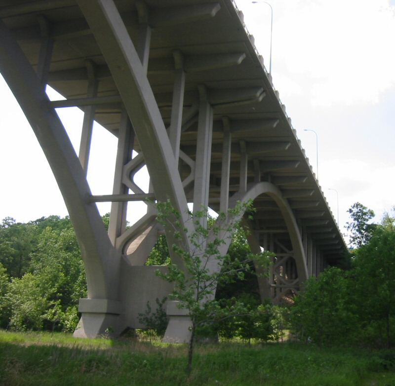
 Ein Blick auf die Unterseite der Brücke
Quellen
Flussaufwärts
Interstate-494-BrückeQuerungen des Minnesota Rivers Flussabwärts
Fort Snelling Park Foot BridgeKategorien:- Straßenbrücke in den Vereinigten Staaten
- Bogenbrücke in den Vereinigten Staaten
- Denkmal im National Register of Historic Places (Minnesota)
- Erbaut in den 1920er Jahren
- Brücke in Minnesota

Wikimedia Foundation.