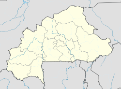
- Aribinda
-
Aribinda Status: commune rurale, département Region: Sahel Provinz: Soum Einwohner: 91.020 (2006)[1] Bürgermeister: Mamadou Maïga Lage 14° 14′ N, 0° 52′ W14.2275-0.86099999999999Koordinaten: 14° 14′ N, 0° 52′ W Aribinda, auch Arbinda, ist sowohl eine Gemeinde (französisch commune rurale) als auch ein dasselbe Gebiet umfassendes Departement im westafrikanischen Staat Burkina Faso in der Region Sahel und der Provinz Soum. Die Gemeinde hatte im Jahr 2006 91.020 Einwohner[2] und liegt nahe der Grenze zu Niger.
Der Flugplatz von Aribinda hat die internationale Kennung XAR.
Am 28. Oktober 1895 wurde ein Protektoratsvetrag mit dem Franzosen Georges Destenave unterzeichnet.
Einzelnachweise
- ↑ Ergebnisse des Zensus 2006
- ↑ Ergebnisse des Zensus 2006. 6. November 2008, abgerufen am 20. Februar 2010 (PDF, französisch).
Departements/Gemeinden in der Provinz SoumAribinda | Baraboulé | Diguel | Djibo | Kelbo | Koutougou | Nassoumbou | Pobé-Mengao | Tongomayel
Wikimedia Foundation.
Schlagen Sie auch in anderen Wörterbüchern nach:
Aribinda Airport — IATA: XAR – ICAO: DFOY Summary Serves Aribinda Location … Wikipedia
Liste der IATA-Codes/X — IATA Codes aller größeren internationalen Flughäfen. IATA Codes A B C D E F G H I J … Deutsch Wikipedia
BF-SOM — Soum Basisdaten Region: Sahel Hauptstadt: Djibo Departements: 9 Hochkommissar: Bernard Sawadogo … Deutsch Wikipedia
Baraboule — Baraboulé Status: commune rurale Region: Sahel Provinz: Soum Fläche: Einwohner: 30.209 … Deutsch Wikipedia
Liste der Flughäfen in Burkina Faso — Die Liste der Flughäfen in Burkina Faso zeigt die zivilen Flughäfen des westafrikanischen Staates Burkina Faso, alphabetisch nach Orten aufgelistet. Zivile Flughäfen Lage ICAO IATA Bezeichnung Aribinda DFOY XAR … Deutsch Wikipedia
Pobe-Mengao — Pobé Mengao Status: commune rurale Region: Sahel Provinz: Soum Fläche: Einwohner: 23.691 … Deutsch Wikipedia
Haute-Volta — Pour les articles homonymes, voir Volta. Haute Volta 1919 – 1932 1947 – 1958 … Wikipédia en Français
Ouagadougou Airport — IATA: OUA – ICAO: DFFD … Wikipedia
Koromfe — belongs to the Central Gur branch of the Niger Congo language family. language name=Koromfe nativename=Koromfe familycolor=orange states=Burkina Faso speakers=10,000 fam1=Niger Congo fam2=Atlantic Congo fam3=Volta Congo fam4=Gur… … Wikipedia
Bobo Dioulasso Airport — IATA: BOY – ICAO: DFOO Summary Airport type Public Operator Government Serves Bobo Dioulasso … Wikipedia

