Orab

Orab
Mount Orab
Luftbild von Mount Orab
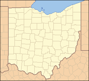
Lage in Ohio
Mount Orab (Ohio)
DEC
Mount Orab
Mount Orab
Basisdaten
Staat: Vereinigte Staaten
Bundesstaat: Ohio
County: Brown County
Koordinaten: 39° 2′ N, 83° 56′ W39.029722222222-83.925287Koordinaten: 39° 2′ N, 83° 56′ W
Zeitzone: Eastern Standard Time (UTC−5)
Einwohner: 2307 (Stand: 2000)
Bevölkerungsdichte: 235,4 Einwohner je km²
Fläche: 9,8 km²
davon 9,8 km² Land
Höhe: 287 m
Postleitzahl: 45154
Vorwahl: +1 937
FIPS: 39-52906
GNIS-ID: 1065073
Webpräsenz: http://www.mtoraboh.us/
Bürgermeister: Bruce Lunsford
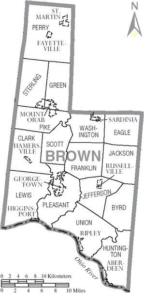
Karte von Brown Country

Mount Orab ist ein Dorf im Brown County, Ohio, Vereinigte Staaten. Es liegt etwa 19 Kilometer nördlich von Georgetown, dem Verwaltungssitz des Countys. Nach Einwohnern ist es die größte Siedlung in der Green Township. Bei der Volkszählung im Jahr 2000 lag die Bevölkerungszahl bei 2.307 Einwohnern.

Der Name ist eine Ableitung von [Mount] Horeb, dem Berg, auf dem Mose gemäß der Bibel die Zehn Gebote empfangen hat.

Dem Grundstein für das Dorf legte Daniel Keethler am 3. September 1850. Das kleine Dorf wuchs zunächst nur sehr langsam. Das änderte sich erst, als am 19. April 1877 die Cincinnati & Eastern Railroad das Dorf erreichte.

1970 soll hier Pfarrer Caroll Jay seine Frau Dolores mittels Hypnose dazu gebracht haben, xenoglosses Deutsch zu sprechen. Dies wurde als Fall Dolores Jay bekannt.

Weblinks


Wikimedia Foundation.

Игры ⚽ Поможем сделать НИР

Schlagen Sie auch in anderen Wörterbüchern nach:

  • Mount Orab (Ohio) — Mount Orab Villa de los Estados Unidos …   Wikipedia Español

  • Mount Orab, Ohio —   Village   Aerial view of central Mt. Orab …   Wikipedia

  • Mount Orab — Mount Orab …   Deutsch Wikipedia

  • Mount Orab — Mount Orab, OH U.S. village in Ohio Population (2000): 2307 Housing Units (2000): 932 Land area (2000): 3.796111 sq. miles (9.831882 sq. km) Water area (2000): 0.000000 sq. miles (0.000000 sq. km) Total area (2000): 3.796111 sq. miles (9.831882… …   StarDict's U.S. Gazetteer Places

  • Mount Orab, OH — U.S. village in Ohio Population (2000): 2307 Housing Units (2000): 932 Land area (2000): 3.796111 sq. miles (9.831882 sq. km) Water area (2000): 0.000000 sq. miles (0.000000 sq. km) Total area (2000): 3.796111 sq. miles (9.831882 sq. km) FIPS… …   StarDict's U.S. Gazetteer Places

  • Mount Orab — Original name in latin Mount Orab Name in other language State code US Continent/City America/New York longitude 39.02757 latitude 83.91965 altitude 287 Population 3664 Date 2011 05 14 …   Cities with a population over 1000 database

  • National Register of Historic Places listings in Brown County, Ohio — Location of Brown County in Ohio This is a list of the National Register of Historic Places listings in Brown County, Ohio. This is intended to be a complete list of the properties and districts on the National Register of Historic Places in… …   Wikipedia

  • Green Crest Motel — (Mount Orab,США) Категория отеля: 1 звездочный отель Адрес: 741 South High Street …   Каталог отелей

  • Brown County, Ohio — Infobox U.S. County county = Brown County state = Ohio founded year = 1819cite web|url = http://www.odod.state.oh.us/research/FILES/S0/Brown.pdf|title = Ohio County Profiles: Brown County |accessdate = 2007 04 28 |publisher = Ohio Department of… …   Wikipedia

  • Ohio State Route 32 — State Route 32 Route information Maintained by ODOT Length: 182.69 mi[1 …   Wikipedia

Share the article and excerpts

Direct link
Do a right-click on the link above
and select “Copy Link”