Peace Arch Provincial Park — Der Peace Arch in Washington von der Südseite Der Peace Arch Park liegt auf der Grenze zwischen dem US Bundesstaat Washington und der kanadischen Provinz British Columbia, unmittelbar an der Küste des Puget Sound und damit am westlichen Ende der… … Deutsch Wikipedia
Peace Arch Provincial Park — Infobox protected area name = Peace Arch Provincial Park iucn category = V caption = Location of Peace Arch Provincial Park in British Columbia locator x = 162 locator y = 240 location = Canada nearest city = Surrey lat degrees = 49 lat minutes … Wikipedia
Peace Arch Park — Peace Arch Provincial Park IUCN Kategorie II … Deutsch Wikipedia
Peace Arch Park — is a park straddling the International Boundary between the United States and Canada at the extreme western end of the main contiguous section of the two countries land border, where it reaches Semiahmoo Bay of Puget Sound on the continent s… … Wikipedia
Peace Arch — Infobox nrhp | name =Peace Arch nrhp type = caption = The Peace Arch from the US side. location= Blaine, WA Surrey, BC lat degrees = 49 | lat minutes = 0 | lat seconds = 7.66 | lat direction = N long degrees = 122 | long minutes = 45 | long… … Wikipedia
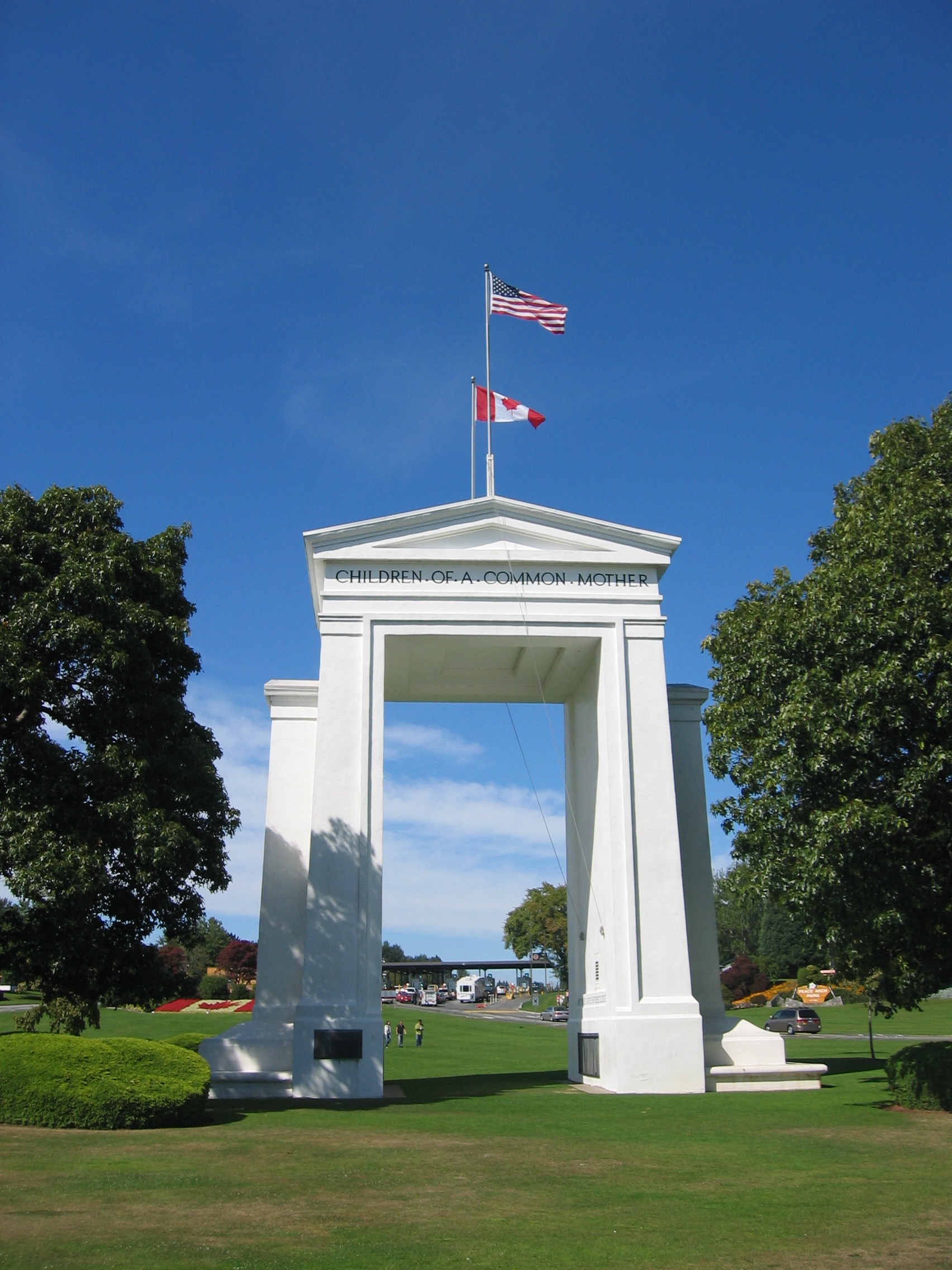
Peace Arch — Der Peace Arch von der amerikanischen Seite aus gesehen Der Peace Arch (dt. Friedensbogen) ist ein Monument an der kanadisch amerikanischen Grenze, zwischen den Städten Surrey in der Provinz British Columbia und Blaine im Bundesstaat Washington.… … Deutsch Wikipedia
Peace Arch — Arche de la Paix Arche de la Paix Vue générale de l édifice Présentation Période ou style Néoclassicisme Type Arc … Wikipédia en Français
Cutts Island State Park — in Pierce County, Washington is a 2 acres (0.81 ha) marine park in the Washington State Park System.[1] It comprises the entirety of Cutts Island in Carr Inlet, 0.5 miles (0.80 km) offshore from Kopachuck State Park, and is accessible… … Wikipedia
McMicken Island State Park — in Mason County, Washington is a Washington State Park accessible only by boat.[1] It consists of the 11.5 acres (4.7 ha) of forested McMicken Island in south Puget Sound, including 1,661 feet (506 m) of saltwater shoreline with a… … Wikipedia
Ocean City State Park — in Grays Harbor County, Washington is a camping park in the Washington State Park System.[1] It consists of 170 acres (69 ha) of ocean beach, dunes, and dense shore pine thicket on the Pacific Ocean. Available activities include fishing,… … Wikipedia
 Der Peace Arch in Washington von der Südseite