SAGA GIS

SAGA GIS
SAGA-GIS

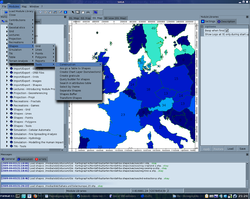
SAGA-GIS v. 2.0.3 unter Kanotix (Debian Lenny)
Basisdaten
Aktuelle Version: 2.0.3
(27. Juni 2008)
Betriebssystem: Windows, Linux
Kategorie: Geoinformationssystem
Lizenz: Free Open Source Software (FOSS)
Deutschsprachig: ja
saga-gis.org (englisch)

Das System für Automatisierte Geowissenschaftliche Analysen (SAGA-GIS) ist eine Open-Source Geoinformationssoftware. Das SAGA-Projekt wird derzeit hauptsächlich am Fachbereich Geographie der Universität Hamburg entwickelt. Hauptentwickler ist Dr. Olaf Conrad.

SAGA-GIS verfügt über einen großen Funktionsumfang. Ursprünglich entstand SAGA-GIS aus einer Vielzahl kleiner, spezialisierter Programme für verschiedene geowissenschaftliche Fragestellungen, die in einem Programm zusammengefasst wurden. Der Schwerpunkt des Programmes liegt auf physisch-geographischen Berechnungen und Darstellungsformen, welche meist auf Basis von Rasterdaten durchgeführt werden.

Darüber hinaus beherrscht SAGA aber auch das Laden, Verändern und Erstellen von Vektordaten und ist damit auch für den Umgang mit thematische Karten sehr gut geeignet. Als einziges Open-Source GIS-Programm beherrscht SAGA die Darstellung von Torten- und Balkendiagrammen.

Installationspakete von SAGA GIS werden für Linux und Windows bereitgestellt. Der Quelltext ist über den Internetauftritt des Projektes herunterladbar. Das Programm ist somit plattformübergreifend nutzbar. Das Ausführen des Programmes von einem portablen USB-Speicher aus ist ohne weiteres möglich.

Weblinks


Wikimedia Foundation.

Игры ⚽ Нужен реферат?

Schlagen Sie auch in anderen Wörterbüchern nach:

  • SAGA-GIS — v. 2.0.3 unter Kanotix (Debian Lenny) Basisdaten Aktuelle Version: 2.0.3 (27. Juni 2008) Betriebssystem …   Deutsch Wikipedia

  • SAGA GIS — Saltar a navegación, búsqueda SAGA Desarrollador Equipo de desarrollo SAGA GIS …   Wikipedia Español

  • SAGA GIS — (System for Automated Geoscientific Analyses) is a free and open source geographic information system used for editing spatial data. It was developed by small team of Dept. of Physical Geography, University in Göttingen, Germany.As the authors… …   Wikipedia

  • SAGA GIS — SAGA (acrónimo inglés de System for Automated Geoscientific Analyses o Sistema para Análisis Automatizados Geocientíficos en español) es un software híbrido de información geográfica (véase Sistemas de Información Geográfica). El primer objetivo… …   Enciclopedia Universal

  • List of GIS software — This is a list of notable GIS software applications. Open source software Most widely used open source applications: *GRASS ndash; Originally developed by the U.S. Army Corps of Engineers, open source: a complete GIS *MapServer ndash; Web based… …   Wikipedia

  • Comte de Saga — Xian de Saga Pour les articles homonymes, voir Saga (homonymie). Sàgā Xiàn · 萨嘎县 …   Wikipédia en Français

  • Comté De Saga — Xian de Saga Pour les articles homonymes, voir Saga (homonymie). Sàgā Xiàn · 萨嘎县 …   Wikipédia en Français

  • Comté de Saga — Xian de Saga Pour les articles homonymes, voir Saga (homonymie). Sàgā Xiàn · 萨嘎县 …   Wikipédia en Français

  • Comté de saga — Xian de Saga Pour les articles homonymes, voir Saga (homonymie). Sàgā Xiàn · 萨嘎县 …   Wikipédia en Français

  • Xian de Saga — Pour les articles homonymes, voir Saga (homonymie). Sàgā Xiàn · 萨嘎县 …   Wikipédia en Français

Share the article and excerpts

Direct link
Do a right-click on the link above
and select “Copy Link”