Samukawa

Samukawa
寒川町
Samukawa-machi
Samukawa (Kanagawa) (Japan)
DEC
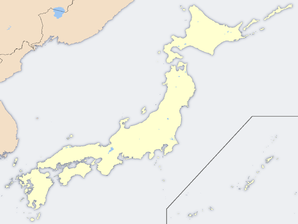
Geographische Lage in Japan
Region: Kantō
Präfektur: Kanagawa
Koordinaten: 35° 22′ N, 139° 23′ O35.373008333333139.383927777787Koordinaten: 35° 22′ 23″ N, 139° 23′ 2″ O
Basisdaten
Fläche: 13,42 km²
Einwohner: 47.569
(1. Mai 2008)
Bevölkerungsdichte: 3.545 Einwohner je km²
Gemeindeschlüssel: 14321-9
Symbole
Baum: Duftblüte
Blume: Narcissus tazetta var. chinensis
Vogel: Silberreiher
Rathaus
Adresse: Samukawa Town Hall
165 Miyayama
Samukawa-machi, Kōza-gun
Kanagawa 253-0196
Webadresse:
Lage Samukawas in der Präfektur Kanagawa
Lage Samukawas in der Präfektur

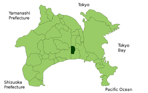
Samukawa (jap. 寒川町, -machi) ist eine Gemeinde im Landkreis Kōza in der Präfektur Kanagawa in Japan.

Sehenswürdigkeiten

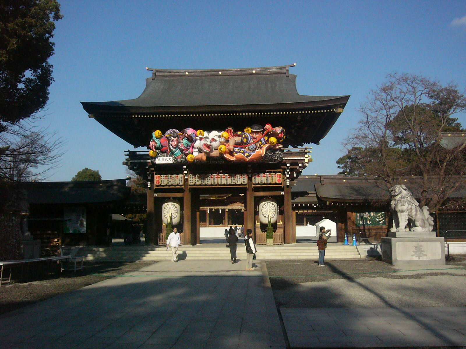
Haupttor des Samukawa-Schreins

Verkehr

  • Straße:
    • Nationalstraßen 44, 45, 46, und 47
  • Zug:

Weblinks


Wikimedia Foundation.

Игры ⚽ Нужно сделать НИР?

Schlagen Sie auch in anderen Wörterbüchern nach:

  • Samukawa (Kanagawa) — Samukawa machi 寒川町 …   Deutsch Wikipedia

  • Samukawa, Kanagawa — Samukawa (寒川町 machi) is a town located in Kōza District, Kanagawa, Japan.As of 2008, the town has an estimated population of 47,569 and a density of 3,505.96 persons per km². The total area is 13.42 km².Transportation;Train stations * JR East… …   Wikipedia

  • Samukawa Station — (寒川駅, Samukawa eki ) is a train station in Samukawa, Kanagawa Prefecture, Japan.LineSamukawa Station is served by the following line:*East Japan Railway Company **Sagami Linetation structureThe station consists of a single island… …   Wikipedia

  • Samukawa-Schrein — Die Haupthalle des Samukawa Schreins Das Haupttor De …   Deutsch Wikipedia

  • Samukawa Shrine — The Samukawa Shinto shrine ()It is 神社 enshrined to 神奈川県高座郡寒川町 Imperial prince mountain. It is 相模国一ノ宮. ..old.. 社格 is a company in country. Ancient times and the Sagamigawa measuring up are presumed that powerful some powerful clans built from… …   Wikipedia

  • Hon-Chiba Station — infobox japan station name=本千葉 namerom=Hon Chiba pref=Chiba city=Chiba ward=Chūō address=1 Nagazu jaloc=千葉県千葉市中央区長洲一丁目 open=1896 oldname=Samukawa presentname=1902 line=Uchibō Line Sotobō Line operator=East Japan Railway CompanyNihongo|Hon Chiba… …   Wikipedia

  • Miyayama Station — 宮山駅 Location Prefecture Kanagawa (See other s …   Wikipedia

  • Ebina (Kanagawa) — 海老名市 Ebina shi Geographische Lage in Japan …   Deutsch Wikipedia

  • Kōza District, Kanagawa — Kōza (高座郡; gun) is a district located in Kanagawa (Sagami Province), Japan, and it once known as Takakura gun in the past. Before the Modern Times, nearly 100 villages were located but since then, the numbers of municipalities reduced by merging… …   Wikipedia

  • Ebina — shi 海老名市 Geographische Lage in Japan …   Deutsch Wikipedia

Share the article and excerpts

Direct link
Do a right-click on the link above
and select “Copy Link”