Seaton Sluice

Seaton Sluice
Seaton Sluice (Vereinigtes Königreich)
Seaton Sluice
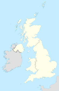
Seaton Sluice
Seaton Sluice auf der Karte des Vereinigten Königreiches

Seaton Sluice ist ein Ort in Northumberland mit 3081 Einwohnern. Es liegt an der Küste an der Mündung des Flusses Seaton Burn, in der Mitte zwischen Whitley Bay und Blyth.

Geschichte

Seaton Sluice war während des 18. Jahrhunderts ein Industriestandort. Kohle wurde vom Hafen verschifft und um den Zugang zur Schifffahrt zu verbessern, wurde in den 1760er-Jahren ein neuer Zugang zur See (the cut) ausgegraben, wobei eine Rocky Island genannte Insel geschaffen wurde. Dies wurde von der Familie Delaval ausgeführt, die in der Gegend viel Land besaß. Das Dorf beheimatete auch eine Flaschenfabrik. Um das 19. Jahrhundert wurde der Hafen zu klein für die damalige Industrie und den Kohlehandel, der nach Tyneside und Blyth umgezogen war. Ein Versuch im frühen 20. Jahrhundert, das Dorf zu einem Touristenort zu entwickeln, scheiterte, weil der Bau einer zum Teil vollendeten Bahnstrecke im Ersten Weltkrieg aufgegeben wurde.

Sehenswürdigkeiten

Das Landhaus „Seaton Delaval Hall“, gebaut von Sir John Vanbrugh, liegt in einem Vorort von Seaton Sluice, an der Straße nach Seaton Delaval.

Holywell Dene, das baumreiche Tal, durch das der Seaton Burn in Seaton Sluice fließt, ist Standort eines größeren Gebäudes, das Starlight Castle genannt wird und von der Familie Delaval gebaut wurde.

55.082983333333-1.4752555555555

Wikimedia Foundation.

Игры ⚽ Поможем написать курсовую

Schlagen Sie auch in anderen Wörterbüchern nach:

  • Seaton Sluice — infobox UK place country = England official name= Seaton Sluice latitude= 55.0826 longitude= 1.4778 population= 3081 shire district= Blyth Valley shire county = Northumberland region= North East England constituency westminster= Blyth Valley post …   Wikipedia

  • Seaton Burn — refers to:*The Seaton Burn, a stream that flows through South Eastern Northumberland and reaches the North Sea at Seaton Sluice, after running through Holywell Dene;*Seaton Burn, a village on the course of the burn, formerly in Northumberland but …   Wikipedia

  • Seaton Delaval — Coordinates: 55°04′57″N 1°28′40″W / 55.0826°N 1.4778°W / 55.0826; 1.4778 …   Wikipedia

  • Delaval — Seaton Delaval Hall, vue nord ouest Delaval est le patronyme d une famille aristocratique du Northumberland en Angleterre, porté du XIe siècle jusqu au XIXe siècle. Leur possession principale était la manoir de Seato …   Wikipédia en Français

  • Blyth, Northumberland — Coordinates …   Wikipedia

  • Delaval — This article is about the surname Delaval. For the Swedish company, see DeLaval. Seaton Delaval Hall, viewed from north west Delaval is the surname of a family of gentry/aristocracy in Northumberland, England, from the 11th century to the 19th… …   Wikipedia

  • New Hartley — Coordinates: 55°05′04″N 1°31′11″W / 55.084558°N 1.519825°W / 55.084558; 1.519825 …   Wikipedia

  • 35UD — Borough of Blyth Valley Lage in Northumberland Status Borough Region North East England Verw.grafschaft …   Deutsch Wikipedia

  • Blyth-Valley — Borough of Blyth Valley Lage in Northumberland Status Borough Region North East England Verw.grafschaft …   Deutsch Wikipedia

  • Sir Ralph Delaval, 1st Baronet — Sir Ralph Delaval (13 October 1622 ndash; 29 August 1691) was an English landowner and politician who was created 1st Baronet of Seaton in the Baronetage of England in 29 June 1660 in the reign of Charles II.He was the son of Robert Delaval and… …   Wikipedia

Share the article and excerpts

Direct link
Do a right-click on the link above
and select “Copy Link”