- Shamal Bahr al Ghazal
-
Schamal Bahr al-Ghazal 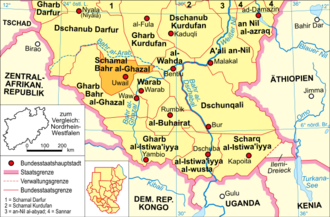
Basisdaten Hauptstadt Uwail Fläche 33.558 km² Einwohner 826.646 (Berechnung 2006) Bevölkerungsdichte 24,63 Einwohner pro km² ISO 3166-2 SD-15 Schamal Bahr al-Ghazāl (arabisch شمال بحر الغزال Schamāl Bahr al-Ghazāl, DMG Schamāl Baḥr al-ġazāl, „Gazellen-Fluss (Nord)“) ist ein Bundesstaat Sudans und gehört zur autonomen Region Südsudan.
Er hat eine Fläche von 33.558 km², eine Bevölkerung von 826.646 Einwohnern (Berechnung 2006)[1] und seine Hauptstadt ist Uwail.
Geographie
Die Vegetation besteht vorwiegend aus Trockensavanne, im Unterschied zum ebenfalls zur Region Bahr al-Ghazal gehörenden Bundesstaat Gharb Bahr al-Ghazal, dessen Landschaft in erster Linie durch Feuchtsavanne gekennzeichnet ist.
Benannt ist die Region nach dem Fluss Bahr al-Ghazal (Gazellenfluss).
Geschichte
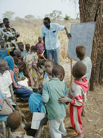
 Dorfschule in Schamal Bahr al-Ghazal
Von 1919 bis 1948 gehörte das Gebiet des heutigen Bundesstaates Schamal Bahr al-Ghazal zur Provinz Äquatoria und von 1948 bis 1976 zur Provinz Bahr al-Ghazal, die 1948 von Äquatoria abgespalten wurde. Von 1991 bis 1994 gehörte das Gebiet von Schamal Bahr al-Ghazal zum neu geschaffenen Bundesstaat Bahr al-Ghazal, der in den Grenzen der Provinz Bahr al-Ghazal von 1948 bis 1976 glich. Am 14. Februar 1994 wurde Schamal Bahr al-Ghazal als Bundesstaat in den heutigen Grenzen abgespalten.[2]
Quellen
- ↑ http://bevoelkerungsstatistik.de zu den sudanesischen Bundesstaaten
- ↑ www.statoids.com: Historische Übersicht der sudanesischen Bundesstaaten

A'ali an-Nil | al-Bahr al-ahmar | al-Buhairat | al-Chartum | al-Dschazira | al-Istiwa'iyya al-wusta | al-Qadarif | al-Wahda | an-Nil al-abyad | an-Nil al-azraq | asch-Schamaliyya | Dschanub Darfur | Dschanub Kurdufan | Dschunqali | Gharb al-Istiwa'iyya | Gharb Bahr al-Ghazal | Gharb Darfur | Gharb Kurdufan | Kassala | Nahr an-Nil | Sannar | Schamal Bahr al-Ghazal | Schamal Darfur | Schamal Kurdufan | Scharq al-Istiwa'iyya | Warab

Wikimedia Foundation.