Stikine-Eiskappe — Der Devils Thumb über der Stikine Icecap Die Stikine Icecap (auch Stikine Icefield genannt) ist eine 21.876 km² große Eiskappe in den Boundary Ranges der Coast Mountains. Es erstreckt sich über die Grenze zwischen Alaska und der kanadischen… … Deutsch Wikipedia
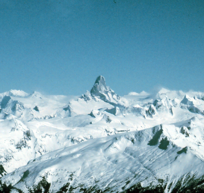
Stikine Icecap — Der Devils Thumb (2.767 m) über der Stikine Icecap Die Stikine Icecap (auch Stikine Icefield genannt) ist eine 21.876 km² große Eiskappe in den Boundary Ranges der Coast Mountains. Es erstreckt sich über die Grenze zwischen Alaska und… … Deutsch Wikipedia
Stikine Icecap — Infobox Glacier | glacier name = Stikine Icecap caption = The Devils Thumb rises above the Stikine Icecap type = Icecap location = Alaska, U.S., British Columbia, Canada coordinates = coord|57|04|14|N|132|13|51|W|type:glacier area = length =… … Wikipedia
Misty Icefield — showing Stave Peak The Misty Icefield (sometimes referred to as the Misty Icefields) is a high glaciated plateau in the Garibaldi Ranges of the Pacific Ranges of the Coast Mountains. It is located in the eastern part of Garibaldi Provincial Park… … Wikipedia
Tidewater glacier cycle — The tidewater glacier cycle is the typically centuries long behavior of tidewater glaciers that consists of recurring periods of advance alternating with rapid retreat and punctuated by periods of stability. During portions of its cycle, a… … Wikipedia
LeConte-Gletscher — Mündung des LeConte Gletschers in die LeConte Bay Der LeConte Gletscher ist ein Gletscher im Tongass National Forest im Panhandle von Alaska. Sein Nährgebiet ist die Stikine Icecap in den Coast Mountains. Er mündet 32 km östlich von… … Deutsch Wikipedia
Coast Mountains — Coast Range Range … Wikipedia
Boundary Ranges — Geobox | Range name=Boundary Ranges other name=Alaska Boundary Range image size=275 image caption=View of the Juneau Icefield. country=Canada country1=United States region=British Columbia region1=Alaska parent=Coast Mountains geology= geology1=… … Wikipedia
Pacific Coast Ranges — Malibu Canyon, Santa Monica Mountains The Pacific Coast Ranges (in Canada) [1] and the Pacific Mountain System (in the United States) [2] … Wikipedia
Ice field — An ice field (also spelled icefield) is an area less than 50,000 km² (19,305 mile²) of ice often found in the colder climates and higher altitudes of the world where there is sufficient precipitation [http://gemini.oscs.montana.edu/… … Wikipedia
 Der Devils Thumb über der Stikine Icecap