Struisbaai

Struisbaai
Struisbaai
Struisbaai (Westkap)
Struisbaai
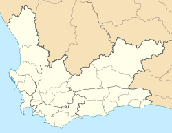
Struisbaai
Basisdaten
Staat Südafrika
Provinz Westkap
Distrikt Overberg
Gemeinde Kap Agulhas
Einwohner 1.000
ISO 3166-2 ZA-WC
-34.81527777777820.05

Struisbaai ist ein Küstendorf in der Gemeinde Kap Agulhas, Distrikt Overberg, Provinz Westkap in Südafrika mit etwa 1.000 Einwohnern. Bekannt ist der Ort für seinen 14 Kilometer langen weißen Sandstrand. Gegründet wurde er Mitte des 19. Jahrhunderts; der Fischerhafen wird heute noch benutzt.

Zur Herkunft des Namens Struisbaai gibt es mehrere Theorien:

entweder strawbay bezieht sich auf die in früheren Zeiten aus Stroh gebauten Fischerhütten
oder abgeleitet vom niederländischen Wort (vogel)struijs für die in früheren Zeiten häufig anzutreffenden Straußenvögel
oder abgeleitet vom alten niederländischen Wort für „gewaltig“, unter Bezug auf den langen Strand

Sehenswürdigkeiten

  • Hotagterklip Cottages, restaurierte historische Fischerhäuser am Ortseingang, alle sind als Nationaldenkmal ausgewiesen. Einige werden jetzt als Ferienhäuser vermietet.
  • Anglikanische Kirche, mit Stroh gedeckte, unter Denkmalschutz stehende Kirche
  • der 14 Kilometer lange Sandstrand
  • die im Hafen frei lebenden Stachelrochen

Weblinks


Wikimedia Foundation.

Игры ⚽ Поможем решить контрольную работу

Schlagen Sie auch in anderen Wörterbüchern nach:

  • Struisbaai — is a coastal settlement in South Africa s Western Cape province. The town is only two hours from Cape Town, lies in the Cape Agulhas municipal region of the Overberg, and is only 4 kilometers from the southernmost point of the African continent… …   Wikipedia

  • The Meermin slave mutiny — …   Wikipedia

  • Oceanview Guesthouse — (Struisbaai,Южно Африканская Республика) Категория отеля: 3 звездочный отель Адрес …   Каталог отелей

  • Anglers Rest — (Struisbaai,Южно Африканская Республика) Категория отеля: Адрес: 1113 Oceanview Drive …   Каталог отелей

  • Zuidste Huisie Fisherman' s Cottage — (Struisbaai,Южно Африканская Республика) Категория отеля: Адрес …   Каталог отелей

  • Hotagterklip — is a small hamlet on the South African coast, close to the village of Struisbaai in the Western Cape.‘Hotagterklip’ is the Afrikaans for left rear stone . The unusual name of this little place comes from the days of the first ox wagon trek, when… …   Wikipedia

  • Cape Agulhas Local Municipality — Zamuni code=WC033 location=Overberg District Municipality, Western Cape area = 2 841 seat=Bredasdorp mayor=Richard Mitchell (ANC) neighbours=Swellendam (north east), Overberg DMA (south east), Overstrand (west), Theewaterskloof (north west)… …   Wikipedia

  • Napier, Western Cape — This article is about the Town Napier in South Africa. For other meanings, see Napier (disambiguation). Napier, Western Cape The NG Kerk (Dutch reformed church) on the main street of Napier Country …   Wikipedia

  • Meermin — Le Meermin (« sirène » en français) est un navire négrier de la Compagnie néerlandaise des Indes orientales (Vereenigde Oost Indische Compagnie, ou VOC) construit à Amsterdam sur un chantier naval de la Compagnie et lancé en 1760. En… …   Wikipédia en Français

  • Cape Agulhas — (Portuguese: Cabo das Agulhas , Cape of Needles ) is the geographic southern tip of the African continent, commonly thought to be the nearby Cape of Good Hope, and is defined for hydrographic purposes to be the dividing point between the Atlantic …   Wikipedia

Share the article and excerpts

Direct link
Do a right-click on the link above
and select “Copy Link”