Swiekatowo

Swiekatowo
Świekatowo
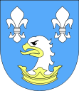
Wappen der Gemeinde Świekatowo
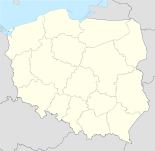
Świekatowo (Polen)
DEC
Świekatowo
Świekatowo
Basisdaten
Staat: Polen
Woiwodschaft: Kujawien-Pommern
Landkreis: Świecie
Geographische Lage: 53° 25′ N, 18° 6′ O53.41972222222218.0922222222227Koordinaten: 53° 25′ 11″ N, 18° 5′ 32″ O
Einwohner: 1.700
Postleitzahl: 86-182
Telefonvorwahl: (+48) 52
Kfz-Kennzeichen: CSW
Wirtschaft und Verkehr
Nächster int. Flughafen: Bydgoszcz
Gemeinde
Gemeindeart: Landgemeinde
Gemeindegliederung: 9 Schulzenämter
Fläche: 64,74 km²
Einwohner: 3.468 (30. Juni 2007[1])
Verwaltung (Stand: 2007)
Gemeindevorsteher: Marek Topoliński
Adresse: ul. Dworcowa 20a
86-182 Świekatowo
Webpräsenz: www.bip.swiekatowo.lo.pl

Świekatowo ist ein Dorf in Polen in der Wojewodschaft Kujawien-Pommern im Powiat Świecki. Das Dorf ist Sitz der gleichnamigen Landgemeinde. Das Dorf liegt etwa 35 Kilometer nördlich von Bydgoszcz an der Bahnlinie Bydgoszcz−Gdynia.

Als die Wehrmacht im September 1939 in Polen einmarschierte, wurde Świekatowo durch Kampfhandlungen weitgehend zerstört. 1942 wurde der Ort in Schweike umbenannt, nachdem er zu preußischer Zeit (Provinz Westpreußen) und erneut ab 1939 Schwekatowo geheißen hatte (in früheren Zeiten auch Schwenkotowo bzw. Sickotowo genannt). Am Ende des Zweiten Weltkrieges marschierte die Rote Armee ein und in der Folge wurde das Dorf wieder Teil Polens.

Weblinks

Fußnoten

  1. Główny Urząd Statystyczny, „LUDNOŚĆ - STAN I STRUKTURA W PRZEKROJU TERYTORIALNYM“, Stand vom 30. Juni 2007

Wikimedia Foundation.

Игры ⚽ Поможем написать курсовую

Schlagen Sie auch in anderen Wörterbüchern nach:

  • Świekatowo — Świekatowo …   Deutsch Wikipedia

  • Świekatowo — Infobox Settlement name = Świekatowo settlement type = Village total type = image shield = subdivision type = Country subdivision name = POL subdivision type1 = Voivodeship subdivision name1 = Kuyavian Pomeranian subdivision type2 = County… …   Wikipedia

  • Swiekatowo — Original name in latin wiekatowo Name in other language State code PL Continent/City Europe/Warsaw longitude 53.41864 latitude 18.09731 altitude 104 Population 1077 Date 2010 09 13 …   Cities with a population over 1000 database

  • Gmina Świekatowo — Infobox Settlement name = Gmina Świekatowo other name = Świekatowo Commune settlement type = Gmina total type = Total image shield = POL gmina Świekatowo COA.svg subdivision type = Country subdivision name = POL subdivision type1 = Voivodeship… …   Wikipedia

  • Schwekatowo — Świekatowo …   Deutsch Wikipedia

  • Małe Łąkie —   Village   Country  Poland Voivodeship Kuyavian Pomeranian …   Wikipedia

  • Szewno — Infobox Settlement name = Szewno settlement type = Village total type = image shield = subdivision type = Country subdivision name = POL subdivision type1 = Voivodeship subdivision name1 = Kuyavian Pomeranian subdivision type2 = County… …   Wikipedia

  • Zalesie Królewskie — Infobox Settlement name = Zalesie Królewskie settlement type = Village total type = image shield = subdivision type = Country subdivision name = POL subdivision type1 = Voivodeship subdivision name1 = Kuyavian Pomeranian subdivision type2 =… …   Wikipedia

  • Jania Góra — Infobox Settlement name = Jania Góra settlement type = Village total type = image shield = subdivision type = Country subdivision name = POL subdivision type1 = Voivodeship subdivision name1 = Kuyavian Pomeranian subdivision type2 = County… …   Wikipedia

  • Lipienica, Świecie County — Infobox Settlement name = Lipienica settlement type = Village total type = image shield = subdivision type = Country subdivision name = POL subdivision type1 = Voivodeship subdivision name1 = Kuyavian Pomeranian subdivision type2 = County… …   Wikipedia

Share the article and excerpts

Direct link
Do a right-click on the link above
and select “Copy Link”