The Olgas

The Olgas
Kata Tjuṯa
Kata Tjuṯa

Kata Tjuṯa

Höhe 1.069 m
Lage Northern Territory, Australien
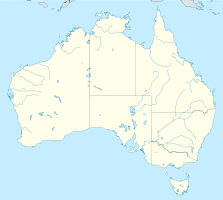
Geographische Lage 25° 17′ 57″ S, 130° 45′ 29″ O-25.299166666667130.758055555561069Koordinaten: 25° 17′ 57″ S, 130° 45′ 29″ O
Kata Tjuṯa (Australien)
DEC
Kata Tjuṯa
Alter des Gesteins ca. 600 Mio. Jahre

Die Kata Tjuṯa (die Olgas) sind eine Gruppe von 36 Inselbergen in Zentralaustralien ca. 51 km entfernt von dem Ort Yulara. Gemeinsam mit dem 30 km entfernten Uluṟu (Ayers Rock) bilden sie den Uluṟu-Kata-Tjuṯa-Nationalpark. Der höchste Fels ragt 564 m aus der Umgebung heraus (1.069 m). Kata Tjuṯa bedeutet in der Anangu-Sprache viele Köpfe.

Die Kata Tjuṯa wurden von ihrem europäischen Entdecker Ernest Giles nach der Königin Olga von Württemberg die Olgas genannt. 1995 wurden sie wieder offiziell in Kata Tjuṯa umbenannt.

Geologie

Die Kata Tjuṯa sind vor ca. 600 Mio. Jahre gemeinsam mit dem Uluṟu entstanden und sind mit diesem unterirdisch verbunden. Im Gegensatz zum kompakten Uluṟu bestehen die Kata Tjuṯa aus einem grobkörnigen Konglomerat aus Granit, Gneis und weiterem vulkanischen Gestein, welches die Verwitterung in einzelne Kuppen begünstigte.

Bedeutung

Die Kata Tjuṯa sind den Anangu heilig. Ihnen wird Schöpferkraft aus der Traumzeit zugesprochen. Die Kata Tjuṯa werden von den Anangu-Männern für Rituale gebraucht. Der Zutritt für Touristen ist deshalb äußerst eingeschränkt. Ein einzelner Wanderweg im Valley of the Winds ist der Öffentlichkeit zugänglich (die Rundwanderung dauert je nach Wandertempo drei bis fünf Stunden). Ein weiterer kurzer Wanderweg führt vom Besucherparkplatz als Sackgasse zwischen zwei „Köpfen“ entlang (Hin- und Rückweg in ca. 30 min bis 1 Std.)

Panorama
Panorama

Weblinks


Wikimedia Foundation.

Игры ⚽ Нужна курсовая?

Schlagen Sie auch in anderen Wörterbüchern nach:

  • The Olgas — noun Former name of Kata Tju x1E6F;a …   Wiktionary

  • Olgas Square — For other uses, see Olga (disambiguation). Olgas Square (Greek: Πλατεία Όλγας, Plateia Olgas) is the older and popular name for the Ethnikis Antistaseos Square (Πλατεία Εθνικής Αντιστάσεως, Plateia Ethnikis Antistaseos) in the city of Patras,… …   Wikipedia

  • Olgas — Kata Tjuṯa Kata Tjuṯa Höhe 1.069 m Lage Northern Territory …   Deutsch Wikipedia

  • Geography of the Northern Territory — The Northern Territory occupies the north central part of the continent of Australia. The Northern Territory is bordered on the west by Western Australia, to the south by South Australia and in the east is Queensland. In the Top End of the… …   Wikipedia

  • Olgas — ▪ tors, Northern Territory, Australia Aboriginal  Kata Tjuta , also called  Olga Rocks         tors (isolated weathered rocks) in southwestern Northern Territory, Australia, comprising a circular grouping of some 36 red conglomerate domes rising… …   Universalium

  • Olgas — /ˈɒlgəz/ (say olguhz) plural noun the → Kata Tjuta …  

  • Sails In The Desert Hotel Ayers Rock (Ayers Rock) — Sails In The Desert Hotel Ayers Rock country: Australia, city: Ayers Rock (Yulara) Sails In The Desert Hotel Ayers Rock Slip into comfort and luxury, right in the heart of the Central Australian Outback at Sails in the Desert Hotel. Named after… …   International hotels

  • Horse the Band — Not to be confused with Band of Horses. Horse the Band Horse the Band in 2009. Pictured from left to right : Nathan Winneke, David Isen, Erik Engstrom, Daniel Pouliot. Background information Ori …   Wikipedia

  • Олгас — (Olgas, the)Olgas the, хребет, горный хребет в Северной территории, центр. Австралия, включающий 36 куполообразных, с красными вершинами гор, сложенных валунами и галькой. Гора Олга (550 м) – его наиболее высокое куполообразное возвышение,… …   Страны мира. Словарь

  • Kata Tjuta — Coordinates: 25°18′S 130°44′E / 25.3°S 130.733°E / 25.3; 130.733 Kata Tjuta, sometimes written Tjuṯa (Kata Joota) …   Wikipedia

Share the article and excerpts

Direct link
Do a right-click on the link above
and select “Copy Link”