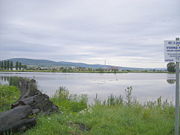
- Tlmace
-
Tlmače
Wappen Karte  Basisdaten
Landschaftsverband (Kraj): Nitriansky kraj Bezirk (Okres): Levice Region: Nitra Fläche: 4,64 km² Einwohner: 4.226 (31. Dezember 2004) Bevölkerungsdichte: 910,78 Einwohner je km² Höhe: 175 Meter Postleitzahl: 935 21 Telefonvorwahl: 0 36 Geographische Lage: 48° 17′ N, 18° 32′ O48.28916666666718.531944444444175Koordinaten: 48° 17′ 21″ N, 18° 31′ 55″ O Kfz-Kennzeichen: LV Gemeindekennziffer: 502863 StrukturGemeindeart: Stadt Gliederung Stadtgebiet: 2 Stadtteile Verwaltung (Stand: Februar 2007)Bürgermeister: Miroslav Považan Adresse: Mestský úrad Tlmače
Námestie odborárov 10
93521 TlmačeWebpräsenz: www.mestotlmace.sk Gemeindeinformation
auf portal.gov.skStatistikinformation
auf statistics.skTlmače (bis 1927 slowakisch auch „Tlmač“; ungarisch Garamtolmács - bis 1902 Tolmács) ist eine Stadt in der Mittelslowakei.
Sie wurde 1075 zum ersten Mal schriftlich als Talmach erwähnt und besteht aus den Teilen Lipník und Tlmače.
Am 1. Januar 1986 bekam der Ort den Status einer Stadt verliehen.
Siehe auch
Weblinks
Gemeinden im Okres LeviceBajka | Bátovce (Frauenmarkt) | Beša | Bielovce | Bohunice | Bory | Brhlovce (Berflowetz) | Čajkov | Čaka | Čata | Demandice (Demenditz) | Devičany (Prandorf) | Dolná Seč | Dolné Semerovce (Untersemered) | Dolný Pial (Unterpill) | Domadice | Drženice (Dersenitz) | Farná | Hokovce (Hockowitz) | Hontianska Vrbica | Hontianske Trsťany | Horná Seč | Horné Semerovce (Obersemered) | Horné Turovce (Oberthur | Horný Pial (Oberpill) | Hrkovce | Hronovce | Hronské Kľačany (Klatschan) | Hronské Kosihy | Iňa | Ipeľské Úľany | Ipeľský Sokolec | Jabloňovce (Almasch) | Jesenské | Jur nad Hronom | Kalná nad Hronom | Keť | Kozárovce (Koscharowetz) | Krškany | Kubáňovo | Kukučínov | Kuraľany | Levice (Lewenz) | Lok | Lontov | Lula | Málaš | Malé Kozmálovce | Malé Ludince | Mýtne Ludany | Nová Dedina | Nový Tekov (Neubarsch) | Nýrovce | Ondrejovce | Pastovce | Pečenice | Plášťovce | Plavé Vozokany | Podlužany | Pohronský Ruskov | Pukanec (Pukanz) | Rybník | Santovka | Sazdice | Sikenica | Slatina | Starý Hrádok | Starý Tekov (Bersenberg) | Šahy (Eipelschlag) | Šalov | Šarovce | Tehla | Tekovské Lužany | Tekovský Hrádok | Tlmače | Tupá | Turá | Uhliská | Veľké Kozmálovce | Veľké Ludince | Veľké Turovce | Veľký Ďur | Vyškovce nad Ipľom | Vyšné nad Hronom | Zalaba | Zbrojníky | Želiezovce (Zelis) | Žemberovce | Žemliare
Wikimedia Foundation.


