Tondirahu

Tondirahu
Nationalpark Matsalu
Nationalpark Matsalu (Estland)
DEC
Lage: Kreis Lääne, Estland
Nächste Stadt: Lihula
Fläche: 486,1 km²
Gründung: 2004

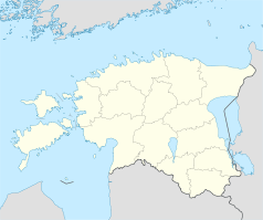
Der Nationalpark Matsalu befindet sich im Westen Estlands. Seine Fläche beträgt 486,1 km². Er umfasst das Gebiet um die Bucht von Matsalu, die umliegenden Landgebiete, den Unterlauf des Flusses Kasari und das artenreiche Seegebiet Väinameri mit seinen über 50 Inseln.

Inhaltsverzeichnis

Gebiet

Das Naturschutzgebiet Matsalu wurde 1957 gegründet, 2004 erheblich vergrößert und zum Nationalpark aufgewertet. Heute gehören zu ihm auch die Naturschutzgebiete von Puhtu-Lahelatu und Nehatu sowie die Landschaftsschutzgebiete von Tuhu und Lihula. 2003 wurde dem Nationalpark Matsalu durch den Europarat die Auszeichnung „Europäisches Diplom für geschützte Gebiete“ verliehen.

Das Verwaltungszentrum befindet sich im Dorf Penijõe, 3 km von Lihula (Kreis Lääne) entfernt.

Flora und Fauna

Der Nationalpark wurde vor allem als Schutzgebiet für die zahlreichen Vogelarten eingerichtet. Heute werden 275 verschiedene Vogel-, 49 Fisch- und 47 Säugetierarten verzeichnet. Darüber hinaus gibt es eine reiche Flora mit 772 teils seltenen Pflanzenarten.

Inseln

Daneben ist der Nationalpark für seine beeindruckende Inselwelt bekannt. Die größten Inseln sind Tauksi, Liia, Sõmeri, Kumari, Papilaid, Sipelgarahu und Tondirahu.

Literatur

  • Matsalu laiud, luhad ja linnud. Tallinn, 1962.
  • Matsalu – rahvusvahelise tähtsusega märgala. Tallinn, 1985.

Weblinks

58.7623.5969444444447Koordinaten: 58° 45′ 36″ N, 23° 35′ 49″ O


Wikimedia Foundation.

Игры ⚽ Нужно сделать НИР?

Schlagen Sie auch in anderen Wörterbüchern nach:

  • Liste der Inseln Estlands — Die Liste der Inseln Estlands gibt einen Überblick über zahlreiche kleine und große Inseln. Vor der estnischen Ostseeküste liegen 1520 Inseln, von denen aber nur 19 bewohnt sind.Die größte ist Saaremaa. Die größten Inseln Estlands… …   Deutsch Wikipedia

  • Saaremaa — This article is about the island. For the village in Võru County, see Saaremaa, Võru County. Saaremaa …   Wikipedia

  • Hiiumaa — Tahkuna peninsula is the most northern part of Hiiumaa Geography …   Wikipedia

  • List of islands of Estonia — This is a list of islands of Estonia. There are 1521 islands. This is not a complete list. CompactTOC10|sections= A B C D E F G H I J K L M N O P Q R S Š Z Ž T U V W Õ Ä Ö Ü X YAAbruka Adralaid Aegna (Wulf) Ahelaid Aherahu (Atla) Aherahu Ahessäär …   Wikipedia

  • Vormsi — Estonia s fourth largest island, Vormsi (German: Worms, Swedish: Ormsö), is located between Hiiumaa and the mainland with a total area of 93 square kilometers. It is part of a rural municipality Vormsi Parish. From mainland, Vormsi is separated… …   Wikipedia

  • Muhu — (German: Mohn/Moon; in Estonian also called Muhumaa), is an island in the Baltic Sea. With an area of 198 km² it is the third largest island belonging to Estonia, after Saaremaa and Hiiumaa. Together with neighbouring smaller islands of… …   Wikipedia

  • Naissaar — from the air Viimsi parish Naissaar …   Wikipedia

  • Osmussaar — Limestone cliff on the east coast of Osmussaar Geography Location …   Wikipedia

  • Manilaid — Manija   village   Manilaid in the Gulf of Riga. Coord …   Wikipedia

  • Noogimaa — is a small, uninhabited Estonian island in the Baltic Sea. Its coordinates are: 58°22′09″N 21°54′45″E / 58.36917°N 21.9125°E / 58.36917; 21.9125. Noogimaa lies just south of the is …   Wikipedia

Share the article and excerpts

Direct link
Do a right-click on the link above
and select “Copy Link”