Tsiafajavona

Tsiafajavona

f1

Tsiafajavona
Höhe 2.642 m
Lage Madagaskar in Afrika
Gebirge Ankaratra
Geographische Lage 19° 20′ 56″ S, 47° 14′ 36″ O-19.34888888888947.2433333333332642Koordinaten: 19° 20′ 56″ S, 47° 14′ 36″ O
Tsiafajavona (Madagaskar)
Tsiafajavona
Besonderheiten Beheimatet die Chamäleonart Calumma hilleniusi

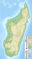
Der Tsiafajavona ist mit 2.642 m der dritthöchste Berg Madagaskars. Lediglich der Andringitra (2.658 m) so wie der Maromokotro (2.876m) sind noch höher. Er gehört zum Ankaratra-Bergmassiv und liegt in der Mitte der Insel.


Wikimedia Foundation.

Игры ⚽ Поможем написать курсовую

Schlagen Sie auch in anderen Wörterbüchern nach:

  • Tsiafajavona Ankaratra — 19° 23′ 00″ S 47° 21′ 00″ E / 19.383333, 47.35 …   Wikipédia en Français

  • Tsiafajavona Ankaratra — Infobox Settlement official name = Tsiafajavona Ankaratra other name = native name = nickname = settlement type = motto = imagesize = image caption = flag size = image seal size = image shield = shield size = image blank emblem = blank emblem… …   Wikipedia

  • Ankaratra — p1f1 Ankaratra Höchster Gipfel Tsiafajavona (2.644 m) Lage Madagaskar …   Deutsch Wikipedia

  • Ankaratra — ▪ mountain region, Madagascar       volcanic mountainous region in central Madagascar (Malagasy), covering an area of approximately 2,000 square miles (5,200 square km) and rising to 8,671 feet (2,643 m) in Mount Tsiafajavona, the nation s second …   Universalium

  • Liste des sommets ultra-proéminents d'Afrique — Cet article recense les sommets ultra proéminents d Afrique, c est à dire les sommets dont la proéminence topographique (ou hauteur de culminance) dépasse 1 500 m. Sommaire 1 Dénombrement 2 Liste 2.1 Afrique de l Ouest …   Wikipédia en Français

  • Madagascar — For other uses, see Madagascar (disambiguation) and Malagasy (disambiguation). Republic of Madagascar Repoblikan i Madagasikara République de Madagascar …   Wikipedia

  • Ankaratra — is an extinct/dormant volcano range located about 50 kilometers southwest of Antananarivo, the capital city of Madagascar. It lies between the towns of Arivonimamo to the North, Ambatolampy to the East, Faratsiho to the West and Betafo to the… …   Wikipedia

  • Manjakatompo — Manjakatompo …   Wikipedia

  • Morarano, Ambatolampy — Morarano …   Wikipedia

  • Mangatano — Mangatano …   Wikipedia

Share the article and excerpts

Direct link
Do a right-click on the link above
and select “Copy Link”